


Looking for the best hiking trail in Killbear Provincial Park?
You’ve certainly come to the right place because my parents often took me camping in the park as a kid. I love this park, and as it is a short drive from my Toronto home, I often head there.
Use my helpful guide to learn about all the Killbear Trails and other activities during your stay.

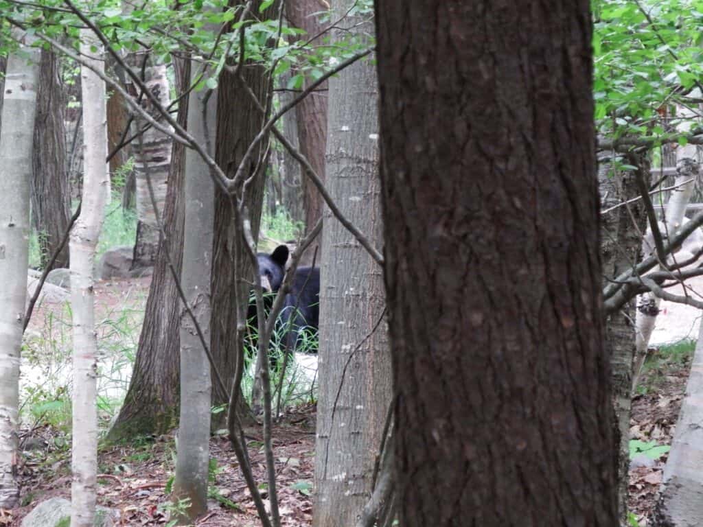
Arriving for our Killbear Trails hiking trip, the sign at the park entrance stated “Active bear in campground”. We didn’t have to go far to find one, as a bear came strolling up shortly after dinner that first night, but we were visiting in September when the park is a bit quieter.
Located on the shores of Georgian Bay near the town of Nobel, Killbear Provincial Park offers several short hiking trails. The park is 1760 hectares (approx. 4349 acres) and is a peninsula surrounded by Georgian Bay on one side and a part of Georgian Bay known as Big Sound on the other.
The Anishinabek called this peninsula Mko-neyaash, which translates to Bear Point.
1. Killbear Park Recreation Trail
Distance: 6.3 km linear trail, taking about 3 hours return
Elevation Gain: 90 meters
Difficulty: Easy to Moderate
Location: From the Park Office to the Lighthouse Point parking lot
Insider Tip about the Killbear Recreation Trail:
Highlights: wildlife, varied scenery
Possible issues: bears along the route
Suitable for: cyclists, walkers, family-friendly, and snowshoeing in winter

The Killbear Park Recreation Trail starts from the park entrance and continues through the entire park for 6 km, passing the Visitor Centre until reaching the Lighthouse Point parking lot. It is a walking and bicycle path that parallels the main park road.
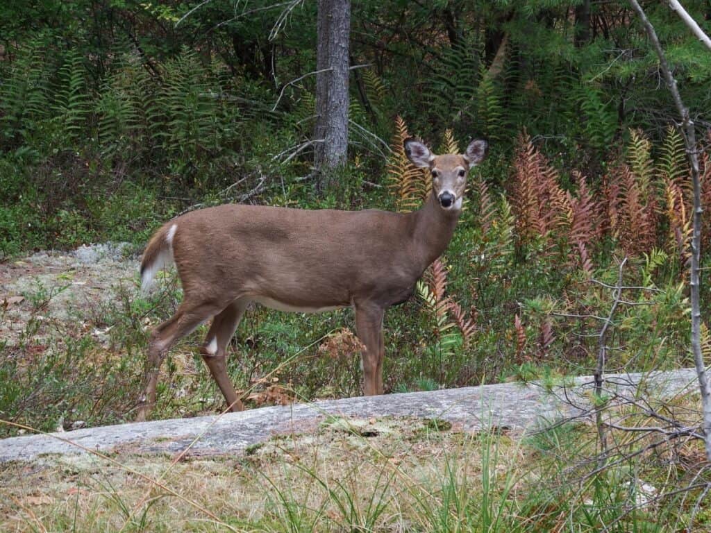
Fairly flat with a few short slopes and sometimes with the road still visible, this recreational trail provides an excellent opportunity to see wildlife, including deer grazing, a fox, porcupines, one of the bears, and others.
We knew the bears often used the trail because fresh “bear poo” could be found each day. I love walking sections of this trail as I often see wildlife, especially deer, in the area around the amphitheater.
The wide surface is a wide crushed-gravel path, sometimes with a few mud patches, winding through hemlock groves with rocky outcrops along the way. This is one of the Killbear hiking trails that is excellent for snowshoeing in the winter as well.
2. Twin Points Trail Killbear
Distance: 1.6 km loop trail, taking about 40 minutes
Difficulty: Easy
Elevation Gain: 33 meters
Location: Turn right just past the Park Office and follow the road to the day-use area
Insider Tip about the Twin Points Trail:
Highlights: views from the points, walking across the rocks of the Canadian Shield
Possible issues: rocks can be slippery when wet
Suitable for: families, dogs on leash

One of the best hikes in Killbear Provincial Park, 2026. We started our walk from the park office and headed along the road next to the Kilcourse Bay campground. In late September, there were only a few campers, even though it was quite warm. We crossed the day-use area to the start of the Twin Point Trail. There are guides at the start with information on corresponding posts along this Killbear trail route.
This trail is part of the Georgian Bay Biosphere Reserve Amazing Places. The Biosphere is one of 20 UNESCO World Heritage sites in Canada. This trail is recommended for bird watchers who may see Warblers, Brown Thrashers, and Eastern Towhees. Note that the Eastern Massasauga Rattlesnake can also be found along the rocky shoreline (they are very shy).
The park newsletter description stated this trail showcases the breathtaking scenery of Killbear Provincial Park, so we were looking forward to seeing this route. We started along the short 1.8 km trail through a hardwood forest, crossing sections of rocky outcrops.
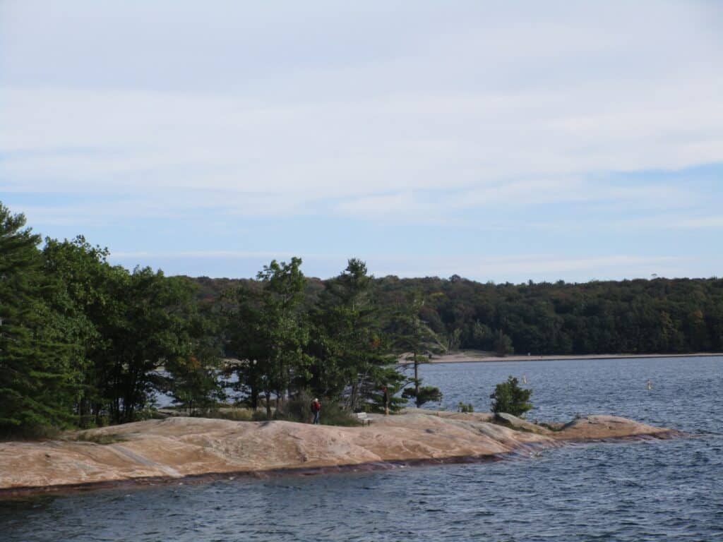
About halfway through, we reached the shore of Georgian Bay, a highlight of the hike. 2 rocky fingers stick out into the waters, providing superb photo opportunities of Kilcoursie Bay, which is where the trail gets its name. You will also notice the wind-swept trees looked like they were right from a Group of Seven painting (which, of course, they were). The dog beach is between the two points of land.
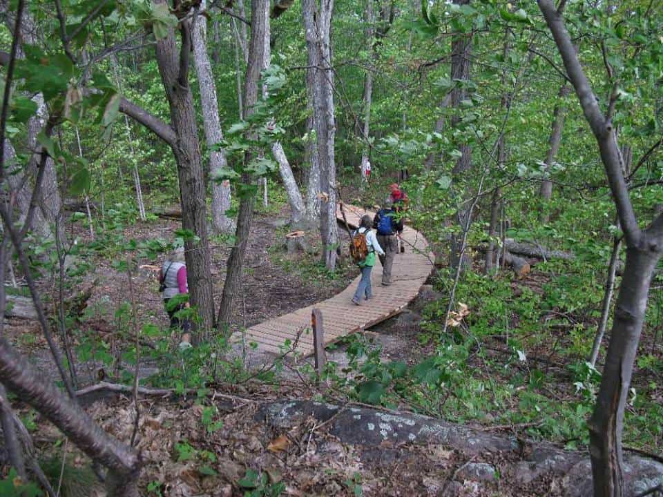
Our group of hikers wanted to linger here, and there were several benches with great views of the water. We then headed inland a bit along a boardwalk before reaching another rocky promenade. It was then back into the woods and back to the park office for about 5 km in the total distance so far. And yes, this short hike did offer breathtaking scenery as promised.
3. Lookout Point Trail Killbear

Distance: 3.5 km loop trail, taking about 1 1/2 hours
Difficulty: Moderate
Elevation Gain: 57 meters
Location: parking lot on the left side of the road, just past Blind Bay Road
Insider Tip about the Lookout Point Trail:
Highlights: view of the sound, walking along the boardwalk
Possible issues: rocky, so watch your step
Suitable for: families, dogs on leash

We then continued our hike along the pedestrian/bicycle path, which parallels Killbear Park Road for about a kilometer until reaching the start of the Lookout Point Trail. The park newsletter description of the Killbear Provincial Park trails stated this is a 3.5 km loop that winds through a mixed upland forest with a view of Big Sound on Georgian Bay. You can pick up a trail guide from the box located in the parking lot.
So, heading into the hardwood forest again, we had to watch out because there were many rocks and roots along the path. There were also many different types of mushrooms providing photo opportunities as well. Shortly, we reached a boardwalk bordered by trees draped in autumn colours.

A short climb brought us to the lookout with breathtaking views of Georgian Bay. Even better, there were two picnic tables where we could enjoy the scenery and our lunches. We completed the loop and headed back for a distance of 11-12 km on both trails.
4. Lighthouse Point Trail Killbear

Distance: 800-meter loop trail, which takes about 25 minutes to complete
Difficulty: Easy to Moderate
Elevation Gain: 14 meters
Location: follow Killbear Road to the parking lot at the end
Insider Tip about the Lighthouse Point Trail:
Highlights: view from the Lighthouse of Georgian Bay & Big Sound, the Lighthouse itself
Possible issues: rocky, can be crowded
Suitable for: families, dogs on leash

Easy walk to the right from the parking lot; you walk along the shores of Georgian Bay, which is one of the busiest Killbear hikes. It is forested, and there are some granite rock faces; then you climb over some rocks to the lighthouse at Killbear Point, on the tip of the park. From the rocky outcrops great views of Georgian Bay.
The return path through the forest back to the parking lot is much easier and more relaxed.
5. Killbear Shoreline Hike

Distance: unofficial route of about 8 km linear hike, taking about 3 hours
Difficulty: Moderate
Location: From Kilcourse Campground along the shores of Georgian Bay to the Lighthouse Point parking lot.
Insider Tip about the Killbear Shoreline Route:
Highlights: views of Georgian Bay and the famous Killbear Tree
Possible issues: not a signed route, so finding a trail can be difficult at times, and rocky
Suitable for: hikers who like to explore
We started from the park office and cut through the Kilcourse Bay campground straight to the beach on Georgian Bay.
While there is no formal trail, we followed the waterline across a series of beaches, rocky outcrops, and forest paths for about 8 km. The very last section was the short Lighthouse Point Trail, and we stopped for lunch to enjoy the views.
Heading back for the 6 km distance, we walked along the Killbear Recreation Trail, which parallels Killbear Park Road through the entire park. A brief stop was made at the park museum with exhibits on the wildlife, plus a gift shop.
Other Activities in Killbear Provincial Park
Killbear Visitor Centre

The Visitor Centre has 1,000 square meters of exhibit space with interactive exhibits about the park and the surrounding area. In the summer, they have daily snake talks to learn more about the types found in the park.
Popular attractions include the live Massasauga Rattlesnake and Eastern Foxsnake. Located on a stretch of rocky shoreline, the Visitor Centre has stunning views of Georgian Bay.
Interpretive programs

The park offers programs during the summer months, including guided hikes and activities for kids. Also, there are evening programs at the amphitheater and sometimes special musical concerts by local groups.
Beaches

Each campground has its own beach, as does the day-use area. They range from smaller beaches flanked by rocky outcrops to the 2 km horseshoe-shaped beach shared by Kilcoursie, Beaver Dams, and the day-use area.
There is a pet beach along the Twin Points trail. Plus, there is another dog beach located near the Group Camping area, which is the only location in the park where your pets are allowed off-leash.
Other Activities
Other activities in the park include bird watching, cycling, boating, and fishing. For a Killbear canoe rental, you will have to go outside the park to explore the 12 km of shoreline and 3 islands, which are part of the park (Davy, Scott & Cousin).
Killbear Tree
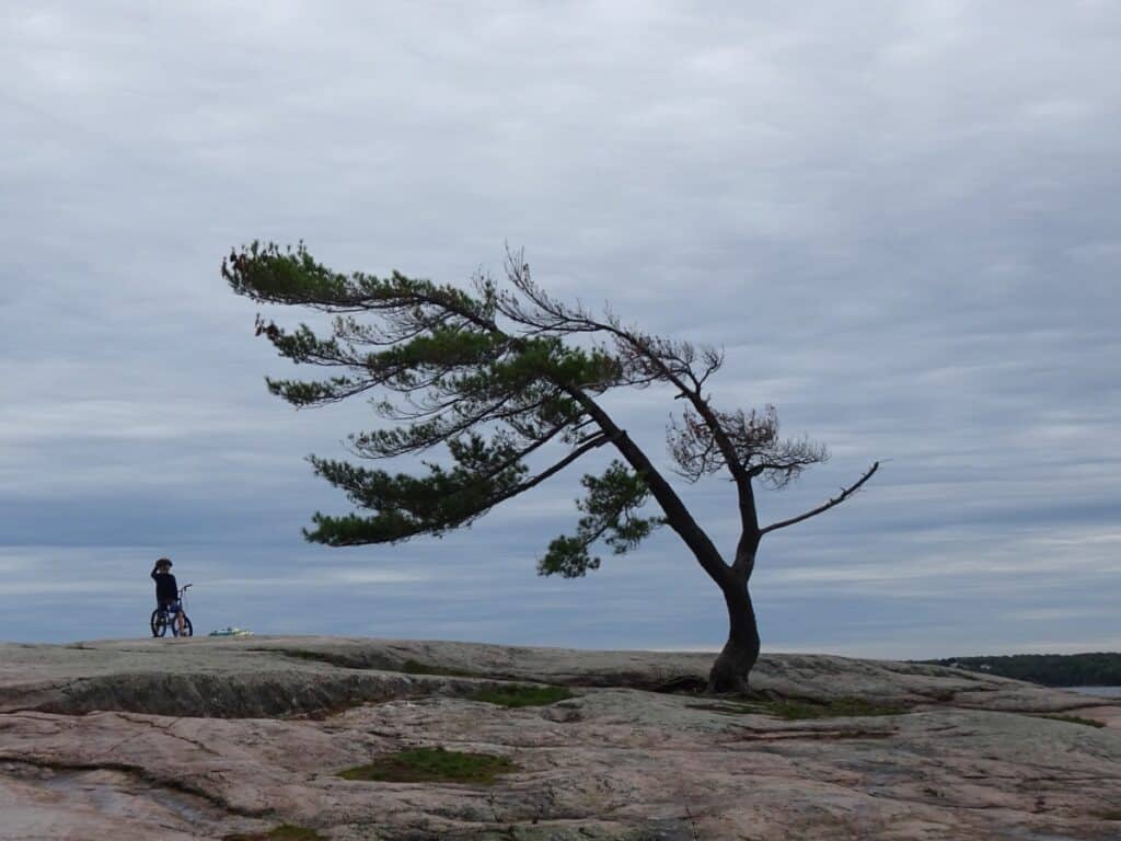
You no doubt have seen the windswept pine, known as the “Killbear Tree” in many photographs and paintings (Group of Seven), and it is very famous. The official tree is located close to Beaver Dams Campground, site 320, and sits on a rocky outcrop called “Sunset Rock”.
Some people believe it is Canada’s most photographed tree.
Things to do near Killbear Provincial Park
In Parry Sound, there is an 8 km Waterfront Trail along the shoreline. The Park to Park multi-use trail (hike/bike) stretches for 230 km from Killbear to Algonquin (includes the Seguin Trail). Another popular attraction here is the 30,000 Island Cruises.
Getting to Killbear Provincial Park
From Toronto to Killbear Park, take Highway 400 just north of Parry Sound and exit along Highway 559 for 19 km to reach the park entrance. The address for the park office is 35 Eddie Ramsay Parkway, and the phone number is 705-342-5402. The drive takes just over 2 ½ hours, a total distance of 271 km.
Parkbus – sometimes offers service from Yonge/Bloor in Toronto to the Killbear Visitor Center; click here to check the current schedule.
The closest town is Nobel, but it is better to stock up for supplies in the much larger Parry Sound, about 30 minutes to the south of the park.
Killbear Provincial Park Reservations
Although Killbear is large, it is also very popular, so it is important to obtain reservations early if you plan on camping, particularly during the summer months of July and August.
Killbear Reservations may be made with the Ontario Parks Reservation System up to 5 months in advance of your arrival.
Killbear Provincial Park Camping
Killbear Camping has seven campgrounds spread throughout the park, with close to 900 sites. Kilcoursie, Beaver Dams, and Harold Point Campgrounds have electrical sites. Kilcoursie & Beaver Dams are located on the longest beach. The sites in Beaver Dams Campground are considered the most popular.
1. Kilcourse Bay Campground – located just inside the park entrance, located on the longest beach, and close to the Twin Point Trail. Sites 1 to 118, some with electrical outlets. Campers love the views here, with some of the best campsites at Killbear at numbers 53 to 69, which are the closest to the beach. Considered the second-best campground in the park.
2. Beaver Dams Campground – considered to have Killbear Provincial Park’s best campsites, as it is located on the longest beach. Also located near the park entrance, with sites from 204 to 378, some with electrical outlets. Sunset Rocks with the famous and often photographed Killbear Tree Group of Seven is located here.
3. Georgian Campground – located midway in the park with sites 400 to 476, large and well spaced, and some with electric outlets.
4. Blind Bay Campground – also located in the middle of the park near the entrance to the Lookout Trail. Sites 700 to 881, none with electrical outlets. A trail leads to a small beach on the Big Sound.
5. Harold Point Campground – has several beaches and trails leading to the amphitheater. Is in a radio-free zone and features a mix of regular and sites with electrical outlets. Considered to be the third most popular in the park.
6. Granite Saddle Campground – quiet (radio-free) with two small beaches and sites 1000 to 1055. A lot of regulars return year after year.
7. Lighthouse Point Campground – located at the far end of the park on Big Sound near the entrance to the Lighthouse trail. Sites 1101 to 1497 are radio-free, and none have electricity. Campsites are not as private as some of the other campgrounds and have no view of the sunset, as located on Big Sound.
In addition, there are group camping sites, and the staff lodge is also available for groups in the off-season from November to April.
FAQs: Killbear Provincial Park Hiking
When is the best time to visit Killbear Provincial Park?
In the summer months of July and August, this popular park can get quite crowded and difficult to obtain campsites. June and September, when the weather is still good, are great times to visit the park.
How long is Killbear Lookout Trail?
A moderate-level hike of 3.5 km normally takes about 1 1/2 hours to walk. You start along a forested boardwalk, arriving at Big Sound on Georgian Bay with magnificent views before returning to a different route.
What is the best site at Killbear Provincial Park?
It is a matter of opinion, but many consider Beaver Dams and Kilcoursie Campgrounds to be the best, as they are both located on a 2 km beach. The sites on Kilcoursie are slightly larger.
How long is Lighthouse Trail at Killbear?
800-meter loop trail from the parking lot. If heading to the right, you will find the Lighthouse Trail a bit rougher than in the other direction. Great views once you arrive at the Lighthouse.
Why is Killbear so popular?
At just over a 2 1/2 hour drive from Toronto, over 800 campsites, lots of trails, beaches, fishing, bird watching, and wildlife, what is not to like? Very popular park.
What is the longest trail in Killbear Provincial Park?
The Killbear Recreation Trail is 6 km long, one way, and runs from the park office to the Lighthouse Trail at the end of the park. The trail runs parallel and sometimes in sight of the main park road. You may see deer, bears, and porcupines on the trail.
How many trails are in Killbear Provincial Park?
There are 4 official trails – 1.6 km Twin Points; 3.5 km Lookout; 800-meter Lighthouse; and the 6 km Recreational trails. You can also walk for 8 km along the shoreline from the Kilcourse Campground to the Lighthouse.
What is Killbear Provincial Park known for?
The famous “Killbear tree” at Sunset Rocks has inspired many painters and photographers; great sunsets and some of the best campsites in Ontario. Opportunities to enjoy the beaches, hike, and canoe.
Looking for more information on hiking in Ontario Parks?
If you are planning a trip to an Ontario Provincial Park and are looking for more information, consider reading some of my other posts:
- Things to do in Algonquin Provincial Park, including the numerous hiking trails
- Lake Superior Provincial Park Trails – review of the 11 hiking trails in the park
- Ranney Gorge Suspension Bridge – located in Ferris Provincial Park
- Trails located along Lake Erie in Point Pelee National Park
- Close to Toronto are the Mono Cliffs Trails
- Best Ontario Provincial Parks near Toronto
What to bring hiking at Killbear
Final Thoughts: Killbear Trails Hiking
With iconic wind-swept trees, a relatively close distance from Toronto, and plenty of campsites, the Killbear Trails are extremely popular all year long.


