


Looking to hike in Rouge Urban National Park?
Well, you certainly have come to the right place. I live minutes away from Rouge Urban National Park and can frequently be found on the trails leading a hike for the outdoor recreation club I belong to or on my own.
With this helpful guide to all the Rouge National Park hiking trails, you can decide which one is best for you. Whichever you choose, have a great time.
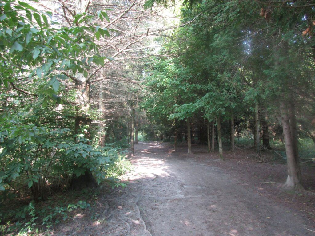
Using the Rouge National Park Hiking Trails is the best way to explore this diverse park, stretching from the Oak Ridges Moraine in the north to Lake Ontario in the south. The plan is to have one continuous trail, but in 2026, sections remain under development.
Rouge National Urban Park is located within the eastern limits of the city of Toronto and communities to the north. This close proximity to the city means easy access, with public transit available in some parts.
Canada’s first national urban park was established on May 15, 2015. It has a total of 79.1 km2 of land and features a collection of trails. There is currently no entrance fee; however, that will change once the park is completed.
Where I Hike the Most
There are a lot of trails in the park, and these are the ones I do the most:
South end of park – Vista Trail & Mast Trails. Beare Hill plus the loop around the wetlands.
Middle part of park – Monarch Trail (Bob Hunter area)
North end of park – Harvest Trail or Northeast Trail
1. Rouge Marsh Trail

Distance: 500 meters one-way (official route), taking 15 to 30 minutes. My route is a longer 5 km
Elevation Gain: none
Difficulty: easy, best for fishing, canoeing, and family walks
Possible issues: limited parking, which can be an issue on weekends, but public transit is available (Lawrence 54A bus)
Location: Eastern end of Lawrence Avenue, Toronto
The Rouge Marsh Trail is currently really short, with expansion plans for it to continue north, bordering the wetlands (see notice below), yet the area is always a hive of activity. There is a short paved path along the shores of Lake Ontario, and the beach at the mouth of the Rouge River makes it very popular.
Enjoy the beach, but swimming is strongly discouraged due to currents and poor water quality caused by storms. There are washrooms, but they can be closed with replacement portable toilets. Over the years, I have seen the Rouge River change direction due to water levels and currents, and thus, the beach can move slightly from year to year. It can also flood with heavy rains.
During my visit, Canada Geese were roaming the sandy beach while, nearby, a large group of day campers were getting ready to set off in canoes.
Walk under the rail bridge. On the north side for better views, walk up the Waterfront Trail ramp, crossing the Rouge River and the wetlands. Also,o below where the marsh and river meet, you can expect to see plenty of fishermen and sometimes canoeists heading upstream.

There are a few interpretive signs along a short boardwalk along the Rouge Marsh Trail with views of the largest remaining wetland in Toronto. The park promotes the rich diversity of the wetland, birds, and shoreline plants found here, and in winter, skaters can be seen in the middle of the pond.
To get to the Rouge Marsh Trail, take the GO train and walk 2.6 km back along Lawrence Avenue or for public transportation, take a TTC 54A bus from just outside the park entrance at Starspray Loop, right at the top of the hill.
Personally, I make this a longer 5 km walk by starting at Port Union Commons Park (next to the Rouge Hill GO Station) and walking along the Waterfront Trail for 2.4 km to Rouge Beach. You will have superb views of Lake Ontario, some additional wetlands, and sand cliffs where swallows make their home. Okay, I did see some rabbits as well. Watch out for cyclists who share the same trail. I return along Lawrence Avenue.
Parks Canada Construction Notice – until spring of 2027
Revitalization of the Rouge Beach Day Use Area, including improved infrastructure to address flooding and climate change impacts. Also, a proposed new trail and raised boardwalk to create a continuous connection from Rouge Beach to the rest of the Rouge National Urban Park trail network.
2. Mast Trail
Distance: 5.3 km loop, taking one to two hours to walk
Elevation Gain: 86 metres
Difficulty: Parks Canada rates it as moderate to difficult only because there are a few steep hills
Possible issues: can be muddy at times, finding parking
Location: 7450 Kingston Road, Toronto, or 55 Twyn Rivers Drive, Toronto
Parking lots open from 7-7:30 a.m. to 9 p.m.
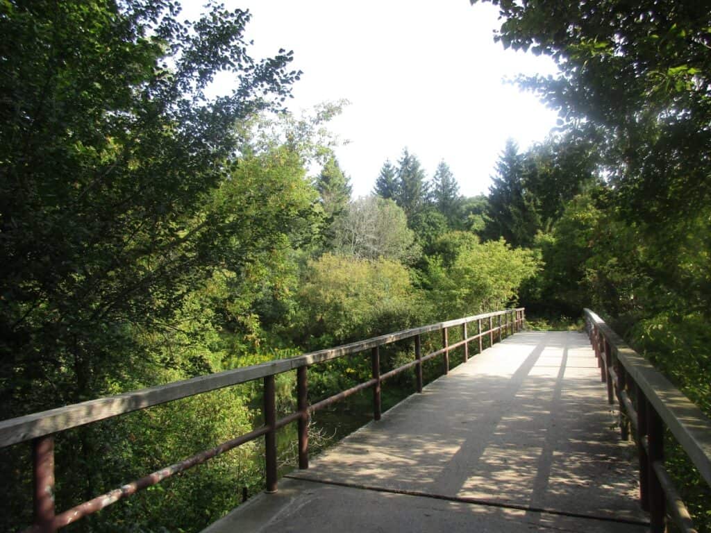
Starting from the Glen Rouge Campground parking lot on Kingston Road and crossing Little Rouge Creek, the Mast Trail is considered one of the nicest trails located right in the city of Toronto. A classic Rouge Valley hike that was once a 200-year logging route where pine trees were cut and floated down the Rouge for the shipbuilders of Europe.
Expect excellent examples of rare Carolinian ecosystems as you walk through the forest, views of the Rouge River or Little Rouge Creek, and lots of inclines with steps. Especially good in the fall with the autumn colours. The trail ends at the Twyn Rivers Day Use Area after passing a dam and crossing the river.
The Glen Rouge Trail is not an official route as you hike through the campground (closed in 2023) and continue on unofficial trails afterward.
3. Glen Eagles Vista Trail

Distance: 600 metres, taking 15 to 30 minutes to walk
Difficulty: Easy
Location: 7 Twyn Road, just off Sheppard Avenue East, with entrance almost immediately to your right and easy to miss.
From the very small, but paved parking lot, you head along a forested dirt trail along the Vista Trail Rouge Valley route with a grass border along the sides. You soon come to a lookout over the Rouge Valley with a bench. This is the best place to relax and enjoy the brilliant views of the Rouge River. The best time to visit is to see Toronto’s autumn colours in early October.
Twyn Rivers Day Use Area
The newly built Twyn Rivers Day Use Area provides access to the Rouge Valley hiking trails and features a large paved parking lot located a short distance off of Sheppard Avenue East along Twyn River Drive and down into the river valley to number 88.
The Celebration, Mast, Vista, and Orchard Rouge Park trails all meet here. Washrooms.
4. Celebration Forest Trail

Distance: 250 meters, takes 10 to 15 minutes to walk
Elevation Gain: flat
Not really one of the Rouge Valley trails, but just a short hike of 10 minutes through a forested area as a connector for the Vista and Orchard Trails. Named to honour the Community leaders and others who worked to establish the park.
5. Vista Trail

Distance: 1.5 km one way, although it is a loop trail, taking 1 to 2 hours
Elevation Gain: 13 meters
Difficulty: Parks Canada rate Moderate; most would say it is easy
Possible issues: parking on weekends, especially in early October
Location: Twyn Rivers Day Use Area, 88 Twyn Road or Zoo Road
Starting from the Twyn Rivers Day Use Area along the Celebration Trail until reaching the Vista Trail. You soon head across the Rouge River and through the tree cover. You will cross a hydro corridor, but the highlight is the Vista Trail’s two-level viewing platform.
The lookout is a great place to view the Little Rouge Creek and Rouge River valleys, especially in the fall. The trail ends at the Zoo River Day Use Area.
6. Orchard Trail

Distance: 2 km one way, taking 1 to 2 hours
Difficulty: Rated by Parks Canada as moderate, not sure why, as flat, although it can be muddy at times
Location: 88 Twyn Rivers Day Use Area or Zoo Road Day Use Area
Starting from Twyn Rivers trailhead, you head across the road on the Celebration Trail before the Orchard Trail branches off to the right (north). Traces of early European settlement can soon be seen on the ‘avenue of trees’, and there was once a mill located here.
It is named Orchard Trail for a reason, as you will be passing former apple orchards along the way. Although you start in a forest, much of the trail is through open fields and a hydro corridor.
Zoo Road Day Use Area
Insider Tip: Located to the east of Meadowvale Road, across from the Toronto Zoo, with a huge unpaved parking lot (with plenty of potholes), a row of portable washrooms, picnic tables, and a park information kiosk. This is one of the most popular sections of the park. The Vista Trail ends near the trail centre with other trails nearby. The Rouge Valley Conservation Centre is also located here. Under construction in 2026.
7. Beare Wetlands Loop

Distance: 2 km loop, connects with the Cedar Trail, taking 30 to 45 minutes
Difficulty: Easy, great for families
Location: East of Zoo Road Day Area
From the parking lot, you head down the hill along a gravel road (only park staff cars permitted) with a lookout (and unofficial side trail) with superb views of Little Rouge Creek about halfway.
Then continue up the hill, where on your right you see the Orchard Trail arriving from Twyn Rivers and on the left is the sign for Cedar Trail. This 1.5 km is a wide and flat route around a large pond with ducks, swans, painted turtles, and marsh vegetation. Return the way you came back down and up the hill.
8. Cedar Trail
Distance: 4.5 km loop including Beare Wetlands, taking 2 to 2 1/2 hours
Difficulty: Moderate to challenging; there are stairs and steep sections. It can be muddy at times
The Cedar Trail and the Beare Wetlands loop from the Zoo Road Day Use Area is one of the busiest routes in the park.
From the trail centre, walk down the hill and up the other side, with the trail starting on your left. The first section is along the Beare Wetlands loop until reaching a T-junction, where you head to the left, often along the river in a forested area.
Many hikers continue along an unofficial path next to the Rouge River, but there are streams to cross. On your return, when you reach the Beare Wetlands Loop, continue straight until reaching the road again and heading back the way you came.
9. Beare Hill Trail & Park

Distance: 1.7 km one way, taking about 20 minutes
Elevation Gain: 55 meters
Difficulty: moderate on a wide paved trail with switchbacks
Actually, Beare Hill Park is owned by the City of Toronto and is not part of Rouge Park. Parks Canada advises you to park at 8145 Finch Ave E. and not cross the railway tracks, which many people do. Located on the site of a former dump, Beare Hill offers a series of switchbacks along a paved route up the side of the hill that takes you to the top.
There are lookout points and benches at the top of Beare Hill Park, along with one of the best views of the urban landscapes and downtown Toronto. Suitable for hikers, trail runners, mountain bikers, and snowshoeing in the winter.
Old Finch Trailhead
Finch Trailhead is on Old Finch Avenue next to the one-way Bailey Bridge. There is a small dirt parking lot with no facilities.
10. Finch Meander Trail

Distance: 0.25 km, taking mere minutes
Location: off Old Finch to the west of Reesor Road, next to the one-lane bridge.
Not even mentioned on the park website or shown on their maps, the Rouge National Urban Park Finch Meander Trailhead starts along a short rocky route leading through a wooded section to a Rouge River lookout point. Accessed after crossing the Old Finch Avenue Bailey Bridge, which is only one lane.
Woodland Day Use Area
The Woodland Day Use Area at 19 Reesor Road features a small dirt parking lot (watch for potholes at the entrance) just south of Steeles Avenue and located along the Rouge River.
11. Woodland Trail

Distance: 4.3 km loop taking 1 1/2 hours
Elevation Gain: 38 meters
Difficulty: Easy
Start from the parking lot along the Little Rouge Creek riverside trail, the Woodland Trail in Rouge Park offers a backdrop of forests and meadows. Beavers are active along this trail. It can be muddy and buggy at times. This trail will change as other park trails eventually connect.
Bob Hunter Memorial Park Trailhead

Bob Hunter was a Canadian hero of the environmental movement, a journalist, and an author who celebrated nature.
Insider Tip: The trailhead in Bob Hunter Memorial Park (7277 14th Avenue) features a large dirt paving lot, portable washrooms, electric car chargers, and picnic tables with 3 trails starting here. Because it is so close to Toronto and its suburbs, it is very popular, although I have never found the parking lot full during numerous visits. One of my favourite hiking areas.
12. Reesor Way

Distance: 1.8 km loop
Difficulty: Easy, although rated moderate by Parks Canada
Issues: In 2026, it remains partially closed, so it needs to be combined with Tanglewood Trail
Starts from the Bob Hunter trail centre heading west through a meadow and open area. At this point, it is almost like a gravel road rather than a trail. The Reesor Family were originally from the Lancaster County area of Pennsylvania, moved to Canada in 1804 and were prominent farmers here. Members of the family still live in the area
In 2025, the second half of the trail is closed, and you would need to continue along the Tanglewood Trail.
13. Tanglewood Trail

Distance: 3.7 loop
Difficulty: Parks Canada rated it moderate; I feel it is easy.
Issues: can only be accessed from Reesor Way or the Monarch Trail
Starts as the Reesor Way for 800 meters, where it branches off. Reesor Way heads to the east. The forested loop eventually follows the Little Rouge and joins the Monarch Trail.
14. Monarch Trail

Distance: 7.6 km loop trail taking 2 to 3 hours
Difficulty: Moderate
When to go: this trail is good all year round
Perhaps the best trail in Rouge Park, my favourite, due to the variety of terrain, and it is a nice 2-hour walk. Heading from the Bob Hunter Trail Centre to the east, and at the T-junction head to the right (the Tallgrass Trail is to the left).
This first section is on a very wide gravel trail and is up and down. Partway along, you meet the Little Rouge and can sit down on the bench to admire the view. After passing the intersection with the Tanglewood Trail, you head up a hill along a winding path in an open area.
Carefully cross Reesor Road, where you will find another small parking lot from where you continue the Monarch Trail Rouge Park by using the exit from that lot on the left. This is a section of a classic Rouge Valley hike before it became a national park. The hamlet of Cedar Grove is just to the south.
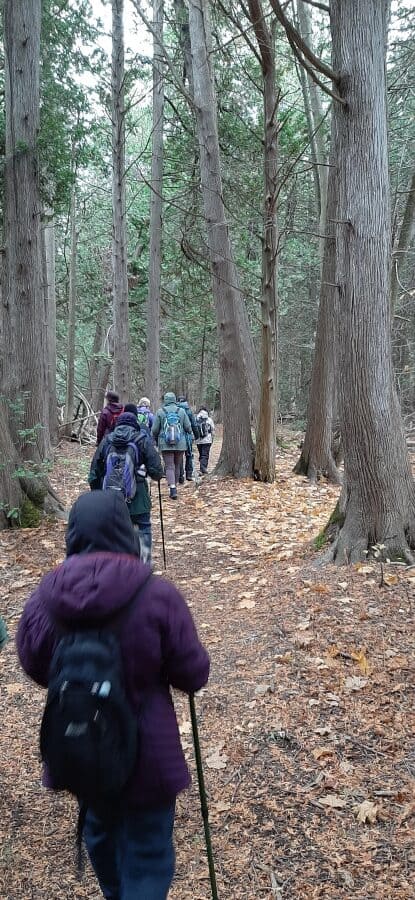
You first encounter a restored stand of white pine. Then, through a mix of habitats from rare cedar savannah to adjacent farm fields. Sections of the trail in this section are overgrown. There are several river lookout points of the Little Rouge along the way.
When you meet the paved trail, head west (to your left). The paved trail to your right leads to another parking lot on 14th Avenue.
Following this paved section, you soon descend to the river with a long modern bridge and afterward have a steep climb up the hill. At the top, you are greeted by woods on the left and farm fields on the right as the trail meanders back to the crosswalk at Reesor Road.
The last section heading back to the Bob Hunter Trail Centre on a gravel surface is fairly easy.
15. Tallgrass Trail

Distance: 3.2 km, taking 1 to 1 1/2 hours
Elevation Gain:
Difficulty: Easy
Starting from the Bob Hunter Trailhead, you head east until reaching a T-Junction, where you take the left route on the Tallgrass Trail, as Parks Canada calls it (while the Monarch Trail heads to the right). You are in an open meadow with plenty of wildflowers and a small pond. Interpretive signs help you understand more about the area.
When you reach the corner of Reesor Road and 14th Avenue, cross to the north side and continue walking along this wide trail, still in the open, so pack sunscreen on a hot day. This part runs parallel to the Donald Cousens Parkway before looping south again and across 14th Avenue to the trailhead.
16. South Central Trail

Distance: 2.1 km one way
Elevation Gain:
Difficulty:
Location: 7833 14th Avenue, east of Reesor
Note: This trail is under development, and the trail will be renamed.
If you start from 14th Avenue and head along the paved section, you will soon discover a picnic area before you connect with the Monarch Trail on its way to the Bob Hunter Trailhead.
If you head north from the small parking lot, you will reach a dead end, so you need to return the same way. Along the way, there is a forested section, meadows, and agricultural fields.
16th Avenue and Major MacKenzie Trailheads
These two trailheads feature a small parking lot and no facilities and, along with the Black Walnut Trailhead, allow access to the Central Trail. Located at 7741 16th Avenue and 7322 Major MacKenzie Drive.
17. Central Trail

Distance: 10.5 km one way
Difficulty: flat
The Central Trail will be renamed and is currently under construction; however, there are sections you can walk. If you head south from the 16th Avenue Trailhead, you will follow Katabokokonk Creek and can go as far as the Locust Hill area just south of Hwy 7, where currently you must turn back. There are 2 lookouts and some benches en route.
Heading north from 16th Avenue, there are 2 boardwalks, and the map shows an additional trailhead at 9619 Reesor Road.

From the small but paved Major Mackenzie parking lot, the trail passes through open farmland, mainly corn. During my visit, I saw a lone cyclist. There is a picnic area that overlooks the Katabokakonk Creek just north of Boyles Cemetery, several lookouts, and a few boardwalks. During one walk, I could see a coyote in a nearby field.
Black Walnut Day Use Area

Located on the east side of 10725 Reesor Road, with washrooms, a covered picnic shelter, picnic tables, and a few parking lots. The main paved lot is on the west side of Reesor Road, accessed from Elgin Mills Road South.
19th Avenue Trailhead

On the north side of the road, with the Harvest Trail arriving from the south. Features a paved parking lot, washrooms, a covered picnic shelter, and a great lookout over Stouffville.
18. Harvest Trail
Distance: 5.1 km one way, taking about two hours. A shorter version, only as far as the 19th Avenue Trail, takes about two hours, having seen all the best sections.
Difficulty: Easy
I start out from the Black Walnut Day Use Area, and you head west for about a kilometre to the T-junction where you meet the Central Trail on the left. However, you turn to the right, crossing Elgin Mills Road East.
The route turns to the west and follows the tree line with farm fields on the other side. Turning north again, you can see pumpkin fields and the city skyline on the left and adjacent farm fields on the right. This wide trail then enters a forested section with rock benches and over a wetland with a boardwalk and lookout.
I then walk up a slight hill where young trees were planted by volunteers in 2022. Near the top is another wooden lookout platform with views of farm fields. This is called the Harvest Trail, as for most of the route, there are farm fields on one side or the other.
Next, you reach the 19th Avenue Trailhead at the top of a hill. The trails then wind down through open fields and a few forested sections until you reach a boardwalk that takes you into Stouffville.
30th Sideroad Trailhead
The Northeast trail comes by this small paved parking lot on 30th Sideroad just south of the Uxbridge-Pickering Townline with a quaint church on the southeast corner.
New Glasgow Trailhead
A large gravel lot with a portable washroom and the start of the Coyote Trail, and not the Northeast Trail, as Parks Canada maps show.
19. Northeast Trail

Distance: 10.7 km one way, taking 4 hours
Difficulty: Easy
Access: Black Walnut, Concession Road 9, Sideline 30, Glasgow Trailheads
Note: This trail will be renamed.
The first section heads east and then north from the Black Walnut Day Use Area to the 9th Concession. Expect to see a mix of forested sections, meadows, and farmlands.
The next part continues north to the Uxbridge-Pickering Townline and has more people walking and cycling on it than the other sections (maybe it was just my timing).
The final section continues north over the Oak Ridges Moraine, where you reach the end of the trail at Webb Road, which has no parking. But don’t go there; instead, follow the Coyote Trail to the New Glasgow Trailhead.
20. Coyote Trail

Distance: 650 meters
Location: New Glasgow Trailhead best way to access the Northeast Trail at the north end
The Coyote Trail does not show on the park map and is really the start/end of the Northeast Trail, as there is no parking at Webb Road where the trail currently ends. During this short hike to the Northwest Trail through the forest, you will also see a pond with aquatic wildlife.
Rouge National Park Guided Hikes
The Parks Canada staff and volunteers offer guided hikes of Rouge Park, a great way to learn about the wildlife, history, and vegetation.
Rouge Park Wildlife

Parks Canada advises there are 44 mammal species, 247 bird species, 27 reptile and amphibian species, and 73 fish species in Rouge National Park. In addition, because of the many meadows along many of the trails, you can expect to see butterflies.
I have seen beavers, coyotes, and deer regularly, and a friend once saw a bear, but I haven’t. Also, at times, there can be plenty of bugs, and the area is known for ticks.
Camping at Rouge National Park
Glen Rouge Campground, the only one located within the city of Toronto, is closed for renovations (2023). There is currently no other accommodation located within the park.
Getting to Rouge Park
Driving – for Rouge Marsh, take Lawrence Avenue East to the very end. Most of the other areas are accessible from either Sheppard Avenue or Reesor Road. Check the trailhead details.
Public Transit – for Rouge Beach, take the Lawrence 54A to the very end and walk a few feet into the park. You can also go to the Rouge Hill GO station and walk just over 2 km, or connect with the TTC 54A route.
At either Kennedy Subway Station by bus or Guildwood GO Station, connect with Bus 86A Scarborough towards the Toronto Zoo. Get off at the intersection of Meadowvale Road and Zoo Road and walk 100 metres to the right down Zoo Road.
Parkbus – in 2025, through a partnership between Parks Canada, Mountain Equipment Company and TD Bank, Parkbus was running the TD Rouge Express, a free service from Yonge/Bloor to the Zoo Road Day Use Area.
Cycling – you can cycle the Waterfront Trail to Rouge Beach. Using the Gateau Corridor, local routes, and a few quiet streets, you can ride to the Zoo Road Day Use Area (currently under construction just north of Ellesmere). There can be a lot of traffic on Reesor Road at times to reach the other trailheads.
Rouge Park map
Rouge National Park Trails map. Note that the Coyote Trail and Finch Meander Trails are not shown on the Parks Canada map. Several trails in the northern part of the park are to be renamed. The routes may also be found on AllTrails.

FAQs: Rouge National Park Hiking Trails
How much does it cost to go to Rouge National Park?
Currently, there is no entry fee for the park. However, once construction is completed (date unknown) on the trails, there will be a parking charge.
Best time to go to Rouge National Park?
Weekdays, when the park is not as crowded for hiking the Rouge Trails. On weekends, particularly in the autumn, parking lots can fill up quickly.
Are Dogs Permitted at Rouge National Park?
Yes, dogs are permitted in Rouge National Park as long as kept on a leash.
What is unique about Rouge National Park?
It is one of the largest urban parks in North America. It is unique in how close it is to the city of Toronto, with some of it within city limits. It features a variety of wildlife and terrain, including beaches, wetlands, farmlands, and forests along the Rouge and Little Rouge Rivers.
Are there Rouge Park Guided Walks?
Yes, there are free guided walks in Rouge National Urban Park covering the flora and fauna, usually on weekends. On the Parks Canada website, you can also find virtual hikes of some of the trails so you can explore them from the comfort of your home.
What to bring on your Rouge Park Hike?
Looking for hiking information on other Ontario Parks?
- Mono Cliffs Provincial Park is only a short drive north of Toronto, and Smokey Hollow Waterfalls Trail is just a little west in Waterdown
- Many visit the very different trails of Algonquin Park
- Another Ontario National Park is Point Pelee National Park, with plenty of hiking opportunities
- Hiking trails near Toronto – all an easy drive with a variety of terrain
Final Thoughts: Rouge Park Hiking Trails
These 20 of the best Rouge Park Hiking Trails are located close to Toronto, with walks over varied terrain and the opportunity to see wildlife, forests, meadows, rivers, and farmland.


