


Looking for the best hiking trails in Algonquin Park?
Well, you certainly have come to the right place. With so many trails of different lengths and difficulty, Algonquin is a park I head to frequently for hiking, as it is only a 3-hour drive from my home.
Use my helpful guide to check out all the best hiking trails in Algonquin Park, including some that aren’t as well-known.
As one of the most popular and scenic provincial parks in Ontario, you would not want to miss hiking on the paths with the most awe-inspiring views. There are 15 interpretive hiking trails in Algonquin Park, plus 2 backpacking trails along the Hwy 60 corridor.
Plus, there are additional Algonquin Park trails that are not as well-known in other, less-visited sections of the park. Our guide is designed to help you plan out your visit for the best experience.

15 Awesome Algonquin Hiking Trails along the Corridor
Algonquin Park hiking trails were created to highlight different aspects of the local environment in the oldest provincial park in Ontario. These interpretive walking trails have trail guide booklets available at the parking lots for a small fee. A valid park permit is required.
The distances for the trails are based on those stated by Algonquin Parks staff, but I have found them to often be incorrect, with actual distances slightly longer. Starting locations are all measured from the west entrance of the park along the 56 km Hwy 60 corridor. Trail entrances are well-signed, but AllTrails can assist if you wish.
1. Whiskey Rapids Trail Algonquin Park
Distance: 2.1 km, takes about 1 hour and 30 minutes
Elevation Gain: 81 meters
Difficulty: One of the easier trails, although rated moderate by park staff due to the climb at the start
Location: Hwy 60 at km 7.2
Highlights: scenic walk along the river with rapids, wildflowers
Possible Issues: river floods and the trail can be muddy in spring or after a hard rain, buggy in spring
Suitable for: families with kids, bird watchers, people with dogs (on leash), looking for a short and easy trail located near the park entrance

This is an easy loop trail of 2.1 km, one of the shortest in the park, and with only 81 meters of elevation, suitable for families. You start with a short and steep walk through the woods to the highlight, Whiskey Rapids, and then continue along the Oxtongue River for about half of the walk. Some of the swampy sections have boardwalks, and it can be very muddy and flood in other sections if it has rained recently. The trail returns through a forest with a few steep parts.
Bird watchers may spot Spruce Grouse, Chickadees, Woodpeckers, and others.
The best time to go is in the early spring when there are higher water levels, but in late spring, you can expect lots of mosquitoes. It can also be especially beautiful in the fall, but again, not on rainy days. Although officially closed in the winter, some people do the trail on snowshoes.
This is the closest trail to the west gate, which makes it popular, and dogs are welcome if kept on a leash. The parking lot fills up quickly at times. Located at a 7.2 km point from the west gate, allows 1.5 hours to walk.
2. Hardwood Lookout Trail Algonquin Park
Distance: 1 km, takes about 45 minutes
Elevation Gain: 85 meters
Difficulty: Moderate
Location: Along Hwy 60 at km 13.8
Highlights: scenic lookout over Smoke Lake, wildflowers in spring, autumn colours
Possible Issues: steep incline that some may find difficult
Suitable for: families with children, dogs on leash, snowshoeing in winter, looking for a short trail

This is the shortest trail in the park with a 1 km loop, but it is rated moderate because of steep uphill and downhill climbs (although only a total of just over 75 meters elevation). The highlight of this walk is the spectacular lookout over Smoke Lake, which can be enjoyed from one of the two benches.
Insider Tip: Some people cheat a bit because, since the lookout is located ¾ of the way around the loop, they just go left at the fork instead of following the official route.
Takes under one hour to do, and dogs are welcome (on a leash). Some visitors like to finish off their day with this walk as it is so short. The trail is closed in the winter. Located at km 13.8 from the west gate.
3. Mizzy Lake Trail Algonquin Park
Distance: 10.8 km and takes about 5 to 6 hours
Elevation Gain: 680 meters
Difficulty: Difficult
Location: On Hwy 60 at km 15.4
Highlights: the best possible chance to see wildlife
Possible Issues: popular, the trail can be crowded and is buggy in spring. It can be muddy at times.
Suitable for: bird watchers and hikers looking for a longer trail. No dogs permitted

A very scenic trail with one of the best chances of seeing wildlife, from moose to otters to beavers. Listed officially as 10.8 km, I think it is closer to 12 km and can be completed in about 5 hours, shorter than the officially listed 6 hours.
Along the route with 581 meters of elevation, expect to find tree roots and rocks along a path that can be very muddy if it has just rained. There are 9 beautiful lakes and ponds, some with benches and boardwalks along the way.
This trail can get crowded, so it is best to get to the parking lot early, which also gives you a higher opportunity of seeing the wildlife. No dogs are allowed on this trail because of the wildlife. Mosquitoes and deer flies can be a bother at times. People also do this hike during the winter months. Located at the 15.4 km mark.
4. Peck Lake Trail Algonquin Park
Distance: 2.3 km, taking 1 hour and 30 minutes
Elevation Gain: a flat 59 meters
Difficulty: Easy to Moderate loop
Location: Along Hwy 60 at km 19.2
Highlights: autumn colours, an excellent chance to see loons, can walk around a lake
Possible Issues: can be muddy at times
Suitable for: families with kids, dogs on leash, snowshoeing (open all year)

An easy 2.3 km loop trail with only 54 meters of elevation that goes around the shoreline of Peck Lake with many viewing points along the way. It is listed as moderate mostly due to the roots and rocks along the route, but families with kids will love it. There are a few sections of boardwalks as well.
A good one to do in the fall because of the colours, and it is also possible to snowshoe during the winter season. Reach at km 15.4.
5. Track & Tower Trail Algonquin Park

Distance: 7.5 km, taking about 4 hours
Elevation Gain: 269 km
Difficulty: Difficult
Location: Hwy 60 at km 24, open year-round
Highlights: scenic lookout, historic railway line remains, streams, and lakes
Possible Issues: lots of rocks and roots, finding parking during autumn weekends, buggy in spring
Suitable for: hikers looking for a more challenging trail, dogs on leash, snowshoeing

Depending on whom you talk with, this is either the best or second-best trail in the park. Listed as a difficult route closer to 10 km than the posted 7.5 km, and if you do the whole thing, there are 269 meters of elevation. Along your journey, you will see some lakes, rivers, a dam, and ruins from a former railway.
Insider Tip: You can do a shorter, less challenging route, as when you arrive at one of the intersections, you can go straight and avoid climbing the hill. This is particularly good in winter if on snowshoes or skis.
Yes, there are lots of roots and rocks typical of Algonquin, and at one point, you have the opportunity to head back to the parking lot (which I do in winter) or tackle the steep climb and over 100 steps. But you are rewarded at the top with a spectacular view of the park from the cliffside vantage point with Cache Lake below. After the rugged descent, the last section is fairly flat.
The best time to go is in the fall to see the colours when the parking lot overflows. Sections can be muddy when it rains. A winter wonderland as well, and is open for cross-country skiing, snowshoes, or if you are wearing icers. Located at km 24.
6. Hemlock Bluff Trail Algonquin Park
Distance: 3.5 km, taking about 2 hours
Elevation Gain: 279 meters
Difficulty: Easy loop trail
Location: Hwy 60 at km 27.2
Highlights: scenic view of Jack Lake
Possible Issues: The parking lot is on the opposite side of Hwy 60, so watch the traffic, muddy at times
Suitable for: families with kids, dogs on leash, snowshoeing in winter

A loop trail of 3.5 km through a Hemlock forest that is not as busy as some of the other trails, which is why many like it. Like other paths in the park, you can plan on lots of roots and rocks and muddy conditions when it rains.
After the uphill climb up some cliffs, you do have a great view of Jack Lake, which is about halfway along, and it follows the shore for a while. There are 278 meters of elevation, and it has nice fall foliage
The small parking lot is located at Km. 27.2 across Hwy 60 from the trailhead. In winter, you can do this one on snowshoes.
7. Bat Lake Trail Algonquin Park

Distance: mid-length 5.8 km, taking 2 hours
Elevation: Gain: 240 meters
Difficulty: Moderate
Location: Hwy 60 at km 30.8 with a parking lot on the north (left) side
Highlights: lookout, naturally acidic bog, boardwalks over marshes, autumn colours
Possible Issues: a steep decline in one spot
Suitable for: families with kids, dogs on leash, hikers looking for varied terrain

A personal favourite of mine is a moderate trail due to the variety of terrain along the way. Slightly longer than the 5.8 km official distance, the walk starts over fairly level terrain. There are some steps and boardwalks along a stream, and after passing your first lake, you start to climb the 240 meters of elevation.
Eventually, you arrive at the lookout (with a bench) with superb views. During our visit in early October, the fall colours were awesome. It was also raining slightly, but with the forest canopy, that was not much of an issue.
After admiring the view, there is a steep descent towards Bat Lake with a few boardwalks to make things interesting as well. The last section is flat and passes the final lake. You can find this trail at Km 30.8. Although the park was packed for the fall colours, this trail was not busy during my visit.
8. Two Rivers Trail Algonquin Park
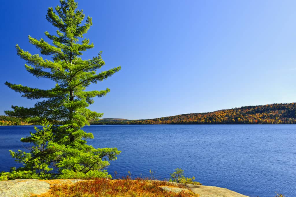
Distance: 2.3 km, taking 1/2 hours
Elevation Gain: 153 meters
Difficulty: Moderate
Location: Hwy 60 at km 31
Highlights: easy ascent to the lookout point
Possible Issues: some steep cliffs, so keep kids and dogs away from the edge, buggy in spring
Suitable for: families with kids, dogs on leash, those looking for a great short hike

The great short loop trail, at 2.3 km about the same length as the Lookout Trail but not as crowded. There are some moderate climbs with elevations of 147 meters, but you are presented with beautiful views.
Expect pesky insects in May and June and a lot of people in October, with many wanting to check out the fall colours. This easy trail is a Km 31.
9. Centennial Ridge Trail Algonquin Park

Distance: 10.4 km, taking 5 to 6 hours
Elevation Gain: 550 meters
Difficulty: Difficult
Location: Hwy 60 at km 37.6
Highlights: scenic views, beaver ponds
Possible Issues: lots of up and down along the trail, steep cliffs, muddy when raining, as one of the best Algonquin Trails can be busy at times, especially in the fall
Suitable for: hikers looking for a more challenging hike, dogs on a leash

Many consider the Centennial Ridges Trail at 10.4 km trail one of the best Algonquin Park hikes because it has one awesome lookout and is a route of a good length. Not an easy one, especially if it rains, as it can get very muddy. However, the climb takes you to a place with breathtaking views, making it all worth it. Elevation of 550 meters.
Typical of many Algonquin Park hiking trails, this one has lots of rocks and roots, so watch your step. One hiker reported seeing a black bear on the route.
The best time to go is in the autumn when the colour changes. The gate was closed during an April visit, which required an additional 2 km walk from Highway 60 to get to the trailhead. Located at Km 37.6.
10. Booth’s Rock Trail Algonquin Park

Distance: 5.1 km, taking 3 hours
Elevation Gain: 232 meters
Difficulty: Difficult
Location: Turn south (right) off Hwy 60 at km 40.3 and go 9 km
Highlights: has one of the 3 top lookouts in the park, an abandoned railbed, and an estate
Possible Issues: some steep climbs
Suitable for: hikers looking for a good mid-length walk; dogs on leash, families with kids old enough to handle climbs and distance

One of the hiking trails in Algonquin Park is a little away from Highway 60. A 5.1 km loop that visits Rock and Gordon Lakes along the way. A moderately challenging route that most people do clockwise, with plenty of uphills at the start heading to a lookout with some of the best views in the park. There are lots of rocks and roots on the ascent. The total elevation on the route is 232 meters.
There are a lot of stairs after the vista point and a final flat stretch along a former railway bed. Some people do cheat a bit by going through the exit and climbing the steps to the top. Shorter and easier trail than Centennial Ridge or Track & Tower. One of the best Algonquin Park trails for fall colours.
Go to Km 40.3 and drive 9 km south from Hwy 60 to reach the trailhead.
11. Lookout Trail Algonquin Park
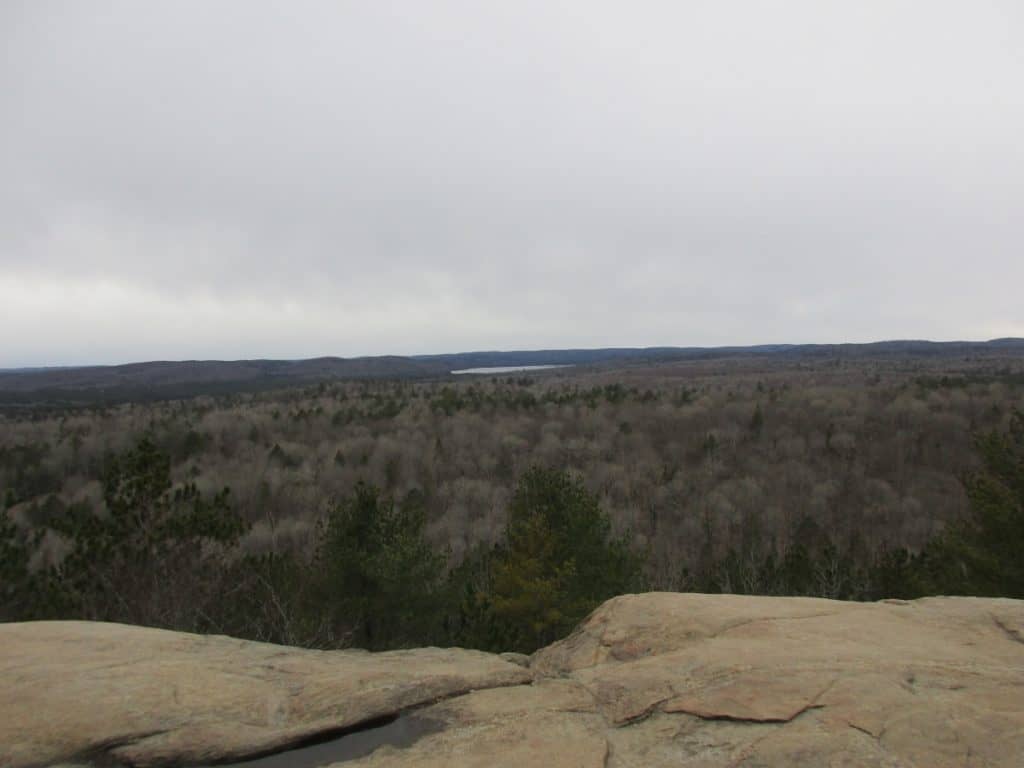
Distance: 2.1 km loop, taking one hour
Elevation Gain: 81 meters
Difficulty: Moderate to difficult (but I saw people of all levels walking these wide trails). Rated difficult only because of the steep ascent and descent
Location: Hwy 60 at km 39.7 km
Highlights: one of the top lookouts in the park to see autumn colours, and wildflowers in May
Possible issues: finding a parking spot during autumn weekends, steep climbs
Suitable for: families, dogs on leash

Extremely popular trail tas one of the best trails in Algonquin Park for fall colours due to the short length of the very wide trail.
From the trailhead, you take a short, fairly flat, and wide section of packed gravel suitable for strollers. You soon reach a divide and head right up an incline of 82 meters, passing a huge boulder and following a stream as it comes down the hill.
At the top, which is slightly past the halfway point of this 2.1 km trail, you reach the edge of a cliff with outstanding views of the countryside, including Kearney Lake. There are benches along the top if you want to stop and take in the view. On the return, there is a steep decline, but again, it is on a wide gravel path, so it is very manageable.
Insider Tip: If the parking lot is full, go to the nearby Big Pines lot and walk over.
When I visited in late April, there were only a few walkers, but in October, it was quite different, with the parking lot overflowing with police directing traffic. Yes, the best time to visit is to see the fall colours. Although rated moderate, this one is suitable for all ages, and I saw plenty of families during my visit. Located at KM 39.7.
12. Big Pines Trail Algonquin Park
Distance: 2.9 km loop, taking 2 hours
Elevation Gain: 100 meters
Difficulty: Easy to moderate
Location: Hwy 60 at km 40.3
Highlights: large pines and remains of the logging industry
Possible Issues: buggy in spring
Suitable for: Families with kids, dogs on leash, hikers looking for a shorter walk near the east end

While this 2.9 km route does not offer any vistas and autumn colours, it is still a great walk through the 200+ year-old white pines. Peaceful and not as crowded as the other trails. Expect lots of rocks and roots and many small inclines on this flat loop (total elevation of 91 meters). You will also see what remains from an 1880s lumber camp. Located at Km 40.3.
13. Spruce Bog Boardwalk Algonquin Park

Distance: 1.5 km loop, taking one hour
Elevation Gain: 58 meters
Difficulty: Easy
Location: Hwy 60 at km 42.5 across from Algonquin Visitor Centre
Highlights: bird encounters, beaver dam, and seeing the Northern Spruce bog
Possible Issues: buggy in spring
Suitable for: wheelchair-accessible, families with kids, stroller-friendly, dogs on leash

Generally, this is considered the easiest walk in the park as it is a wheelchair-accessible boardwalk that takes you through woods and marshlands for 1.5 km with only 58 meters of elevation. Close to the water, you have plenty of photo opportunities. Expect lots of mosquitoes in the spring.
This is a family-friendly one with the Visitor’s Centre located across Hwy 60 at Km 42.5 and is also worth a visit. The Algonquin Park Visitor Centre offers exhibits, a short walk on a boardwalk to a fire tower, a shop, a viewing platform, and food options.
14. Beaver Pond Trail Algonquin Park

Distance: 2 km loop taking 1 1/2 hours
Elevation Gain: 66 meters
Difficulty: Moderate
Location: Hwy 60 at km 45.2
Highlights: 2 ponds with beaver dams and lodges, boardwalk, scenic lookouts
Possible Issues: a lot of staircases, cliffs
Suitable for: hikers looking for a short but scenic walk, families with kids, and dogs on a leash

I have been to the park numerous times and always seemed to miss this trail, but recently had the chance to tackle it, and it has now become one of my favourites. Varied terrain as you start this moderate 2 km loop walk, crossing a short wooden bridge and descending a short hill covered with rocks and roots typical of many Algonquin trails.
Enjoy the next section along the lake, as it is the only flat part you will see. First, a short lakeside walk, then a long boardwalk with benches crossing that same lake. Yes, you can see several beaver lodges on both sides.
After continuing a very short distance along the shoreline, you come to the first set of stairs. For the rest of the trail, you are either going up or down with easy climbs. Although only 66 meters of elevation, you always seem to be on your way up or down. There are several viewpoints, some at water level and another hilltop where you see additional beaver lodges. At one point, you also pass a huge beaver dam.
If you wish to see a Beaver, it is best in October when they repair their dams and their stock of winter food supplies during the day. You also may see moose along this route
Very beautiful trail with 64 meters of elevation, in which some visitors saw beavers, but we did not. Highly recommended, located at Km 45.2.
15. Algonquin Logging Museum and Trail

Distance: 1.3 km, taking one hour
Elevation Gain: 60 meters
Difficulty: Easy
Location: Hwy 60 at km 54.5
Highlights: really an outdoor museum with 20 exhibits, including a working log chute
Possible Issues: none
Suitable for: family-friendly, dogs on a leash.

The wide trail is 1.3 km with 20 exhibits along the way explaining the logging industry and replica boats, log chutes, wagons, and more. Family-friendly, and you wander through the woods and along a river, checking out the displays. Much more interesting than I expected it to be.
There is a 10-minute film in the main building to learn about the history of the area, but it was not available during my visit.
You can still walk the trail even if the museum is closed, with only 59 meters of elevation. Located at Km 54.5 near the East Gate.
Algonquin Park Backpacking Trails
There are 2 Algonquin Backpacking trails for anyone who wishes for a longer hike.
1. Western Uplands Backpacking Trail Algonquin Park
One of two backpacking trails in the park along the Hwy 60 corridor, it offers loops of varying distances of 32, 55, and up to 88 km in length. Rugged yet very scenic. Access is 3 km from the park’s west gate on Highway 60 or the Rain Lake Access Point off Highway 11.
2. Highland Backpacking Trail Algonquin Park
The first loop of 19 km goes around Provoking Lake. If you continue, the entire journey is 35 km, which my brother and I did in two days. Consider it scenic but rugged, with plenty of rocks and roots, with lots of long climbs and descents.
Other Algonquin Park Hiking Trails
Algonquin North
You can access the following 3 trails by taking Hwy 17 east from Mattawa and turning south on Brent Road. Stay at the Brent Campground located on Cedar Lake.
1. Brent Crater Hiking Trail
Distance: 3.1 km loop, taking between one and two hours
Elevation Gain: 137 meters
Difficulty: Moderate
Location: just north of Brent Campground on Brent Road
Hike through the forest to the lookout and view the 3 km wide and 600 meters deep where the remains of an ancient meteorite crater formed 450 million years ago. There are 8 interpretive signs along the way to explain some of the history and geology. Lots of bugs when hiking in the spring. Dogs on a leash are welcome.
2. Brent Historic Site Trail
Distance: 3 km
Elevation Gain: Flat
Difficulty: Easy
Location: just east of the Brent Campground
You can discover Brent’s history while cycling or hiking on the trail (actually, it is a road) around the historic townsite. There are a few of the buildings still standing, including the Brent Store, still open to provide campers with supplies. There are information signs at 5 points around the site.
3. Limestone Trail
Distance: 0.5 km loop, taking 20 minutes
Elevation Gain: none
Difficulty: easy
Location: Trail from the Brent Campground to the beach
Algonquin East
To get there, go west from Pembroke on Barron Canyon Road to the Achray Campground. In the Campground is the Achray Historic Site Exhibit, which also includes a 2.4 km walk.
1. Barron Canyon Hiking Trail
Distance: 1.5 km loop, taking about 45 minutes to walk
Elevation Gain: 100 meters
Difficulty: Moderately steep trail
Location: At the km 29 point on the Barron Canyon Road

A short, steep trail through a forested section and then follows the north rim of the spectacular, 100-meter-deep Barron Canyon with views of the rapids. The trail is short but worth it if you plan to do additional hiking in the area. Dogs on a leash are welcome.
In the past, after the end of the Ice Age, the Barron River carried all the water from Lake Algonquin (prior to the Great Lakes forming) through the canyon.
2. Jack Pine Trail

Distance: 1.6 km out and back trail, taking about 45 minutes
Elevation Gain: 47 meters
Difficulty: Easy
Location: near the Achray Campground
You want to walk this easy trail because it heads to the site where Tom Thomson (one of the Group of Seven) sketched the well-known, “The Jack Pine”.
3. Berm Lake Trail
Distance: 4.5 km loop, taking about 1 1 /2 hours to walk.
Elevation Gain: 115 meters
Difficulty: Moderate
Location: On the edge of Achray Campground

From the campground, the trail goes around Berm Lake, passing through a pine forest with sections of the rock to cross that can be slippery when wet. Dogs on a leash are permitted.
4. Eastern Pines Backpacking Trail
Distances: 6 and 14.8 km loops
Elevation: 447 meters
Difficulty: Good beginner backpacking route
Location: starts on the edge of the Achray Campground

Some hikers just do the 8.4 km part to Stratton Lake, while if you are truly backpacking, head to High Falls with some steeper sections along the way.
Algonquin South
The southern panhandle was added to the park in 1960-61, and you can reach the access point by taking local roads from the town of Haliburton. It is more used by people canoeing than by hikers, but there are a few trails. Kingscote Lake has a few walk-in sites.
1. High Falls Hiking Trail
Distance: 4.0 km out and back
Elevation Gain: 105 meters
Difficulty: Moderate
Location: High Falls parking lot off Elephant Lake Road
From the trailhead, you walk along an old road through a red pine plantation. Rocky at times the trail then follows the York River to beautiful High Falls. Do be cautious and stay on the trail, as there are many crevices, caves, and overhangs if you leave the path. The York River is popular with canoeists.
2. Byers Lake Trail & Gut Rapids
Byers Lake is a Mountain Bike trail that follows an old logging road for 5 km, also used by horses. There are many steep descents, and there can be muddy sections. You then follow the Gut Rapids Spur Hiking Trail for 1/2 a km to the Vista to see the rapids. The total distance is 13 km, and it is only open from June to Thanksgiving.
How to get to Algonquin
Drive up Hwy 400 and at Barrie continue north on Hwy 11 for a distance of 232 km (3 hours) to Huntsville. Exit at Hwy 60 and drive a further 43 km (about 30 minutes) to the west gate, where you can get information and permits. Other routes for getting to Algonquin Park from Toronto.
Parkbus offers limited service from Toronto, and Discover Cars offers rentals if you require transportation.
Know Before You Go
A permit is required to enjoy any of the park facilities, including hiking trails. During summer and autumn weekends, it is best to purchase online in advance as the park does sell out. At other times, purchase online or at the park gate when you arrive.
You can get your daily vehicle permit up to five days in advance to guarantee access. Ontario Parks Reservations online, you can phone by calling toll-free 1-888-ONT-PARK (1-888-668-7275) if in North America. If outside North America, call 1-519-826-5290. Lines open from 7 am to 9 pm. (EST).
How to Prepare for Hiking in Algonquin
In order to prepare for your hiking adventures in Algonquin Provincial Park, you need to be sure to pack accordingly, whether on a day hike or backpacking.
During my treks, there were some things that we brought for a more enjoyable experience.
When reading the reviews on the various hikes, you will note that Algonquin can be quite buggy during the spring months of May and June. Nothing is worse than having these pesky insects around you while hiking, so bring bug spray. You may also consider a bug hat.
During the summer months, you can get a lot of sun while on the trail. I know it is a big problem for me as I can burn quickly, so I always bring sunscreen. I also highly recommend wearing a hat, which helps keep the sun off our faces and helps us stay hydrated longer.
✔ Day Pack
To carry all these items, plus some first aid items. Note that there is often no cell service in the areas you will be hiking.
It may rain during your walk, so pack a raincoat or poncho to keep yourself dry.
✔ Water
Bring more water than you think you’ll need. For long hikes, be sure to bring plenty of water in a bladder (at least 2L) or several large water bottles.
✔ Snacks and lunch
Keep your body fueled with healthy snacks and lunch if on longer hikes. Many of the trails have benches along the route.
FAQs: Hiking Trails in Algonquin Park
When to go hiking in Algonquin Park?
July to October is best, with the autumn season best to view the fall colours. May and June are also popular, but expect it to be buggy and muddy on some of the trails. From December to March, hiking on snowshoes may be available on some trails.
What is the most popular trail in Algonquin Park?
The longer Track & Tower plus Centennial Ridge are the most popular but is considered challenging. The more moderate Bat Lake is much shorter and easier yet with superb scenery. The short Lookout Trail is particularly popular in the autumn.
What is the best easy trail in Algonquin Park?
The Spruce Bog boardwalk is a 1.5 km loop that is flat and wheelchair accessible. Besides the marsh, you can expect to see a lot of birds on this family-friendly trail. Located across from the Algonquin Park Visitor Centre.
What is the hardest trail in Algonquin Park?
Most hikers consider the 10.4 km Centennial Ridge to be the hardest trail in the park. There is a steep climb, but you are rewarded with awesome views once you reach the lookout.
Do you need a permit to hike Algonquin Park?
You require a permit to use any of the park trails, see the Visitor Centre, or use any of the facilities. Day use and seasonal permits are available online, or you can phone or pick one up at the park gates. Some autumn weekends sell out, so you should obtain the permit in advance during that season.
Wrap-Up: Hiking Trails in Algonquin Park
There are plenty of other activities besides hiking in the park, so you will want to read our article on what else to do in Algonquin Park. Also, you might check out our canoe trip on Lake Opeongo.
Algonquin Park offers a wide variety of hiking trails of varied lengths, terrain, and difficulty for all members of your family, so pick your favourite path and head off.


