
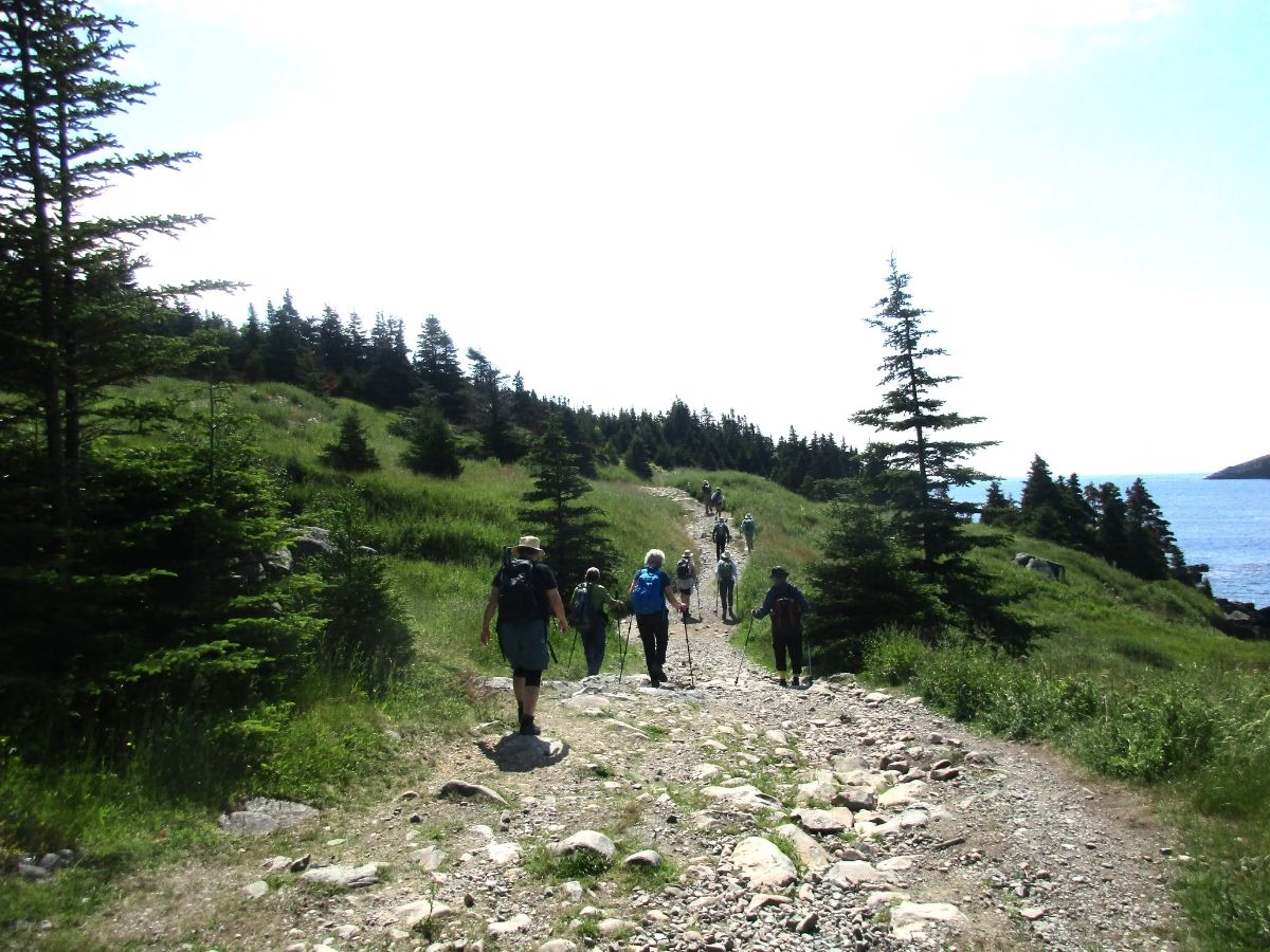

With a few friends, I wanted to check out some of the hiking trails in Newfoundland, so we headed to “The Rock” (a well-known nickname) for 3 weeks. Hiking is one of the best ways to see the province, meet the friendly people, and take in the incredible natural beauty.
I had taken the Marine Atlantic ferry from North Sydney, NS, to Argentia with a quick walk around Castle Hill National Historic Site on arrival, before heading to the East Coast Trail.
Newfoundland Hiking Trails
Here are the 9 best Newfoundland hiking trails listed from east to west. These are not the longest trails or necessarily the hardest, but all are scenic, with varied terrain, and represent the interesting hikes in different parts of Newfoundland. Trail Ratings from AllTrails
I drove to the different trailheads in my own car, but check out Discover Cars if you require a rental vehicle. Picking up your vehicle in St. John’s and dropping it off in Deer Lake will cost more, so plan your trip accordingly.
1. Sprout Path Trail

I started with Sprout Path Trail (part of the East Coast Trail) at Bay Bulls, which provides spectacular scenery during my hike along the coast to a lighthouse where most hikers turn around. But you can continue to make this an 11 km one-way walk.
What impressed me the most was that, although a lot of minor hills, I could still see a sweeping view of the entire coast. The trail was very busy during my visit and was a great introduction to the province. There is a chance to see whales as well.
Sprout Path Trail Details and Information (Rated: 4.7 / 5.0)
Location: East Coast Trail near Bulls Bay. AllTrails map to reach the Sprout Path Trailhead.
Length: 22 km out and back, but most hikers were only going half that distance to the lighthouse.
Elevation Gain: 1,107 for the entire length, but only minor hills on the first part to the lighthouse
Difficulty: Moderate to challenging, depending on the distance
Cost: None
East Coast Trail
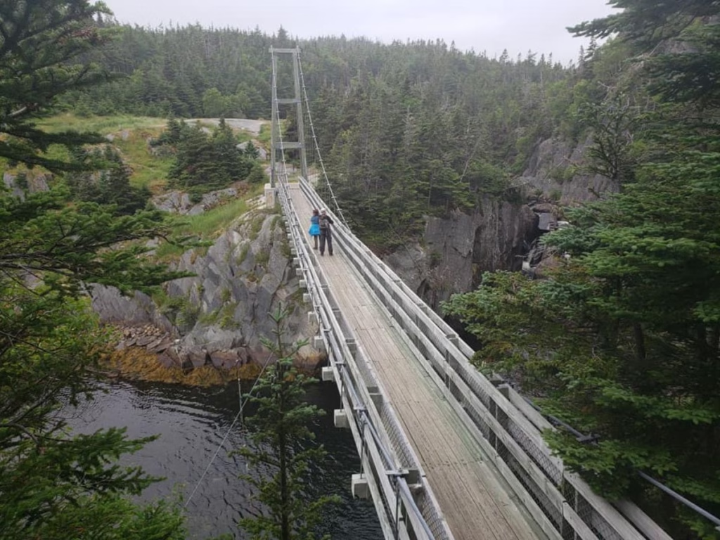
The entire East Coast Trail is 270 km and runs from Topsail to Cappahayden along the rugged coastline, going right through the City of St. John and coastal communities, with plans to extend to 600 km along the Avalon Peninsula. It is part of the Trans Canada Trail, which spans the entire country.
Many residents provide B&B accommodation, a packed lunch, and will drive you to and from different sections of the trail. I stayed at Brown Rabbit Cabins in Tors Cove, just over 40 km south of St. John’s. A great way to meet Newfoundlanders.
2. Cape Spear Trail

For some history, visit the Lighthouse first with free guided one-hour tours at 10:30 a.m. and 2 p.m. Then, there are several trails here, but most hikers will want to hike along the scenic coastline to North Point. If you can arrange transportation, you can continue to Maddox Cove (about 12 km one way).
Along the way, expect boardwalks, easy hiking, and great views. Some people have reported seeing whales. I didn’t see any here, but saw humpback whales and minke whales just to the south.
Cape Spear Trail Details and Information (Rated: 4.7 / 5.0)
Location: Cape Spear Lighthouse National Historic Site on the East Coast Trail just south of St. John’s. AllTrails map for directions to Cape Spear Trail
Length: 8.7 km with longer options available
Elevation Gain: 211 metres
Difficulty: Moderate
Cost: Parks Canada daily fee or Discovery Park
3. North Head Trail & Quidi Vidi

Signal Hill National Historic Site is one of the main attractions in St. John’s, and there are a variety of trails around the site.
From the Visitor Centre, I started by walking the short 0.46 km Gibbet Hill trail for a sweeping view of St. John’s Harbour. Back at the Visitor Centre, take the trail for 500 metres to the summit, passing the Queen’s Battery, until I reach the summit.
I visited the Cabot Tower and took a view of the coast before continuing. The North Head Trail starts from one end of the parking lot and is the most popular trail, with 35,000 visitors each year. I was not surprised, as it was busy during my visit.
Take care, and expect lots of stairs, narrow paths, and adjacent to steep drops as it follows the shore. This may be a concern for persons with a fear of heights. Return the way you came or take part in the Grand Concourse connecting trail back to Signal Hill.
Next, take the Ladies Lookout Trail for 1.3 km across the ridge with views of the Atlantic Ocean coast. The Quidi Vidi Harbour Viewpoint trail was a popular option for walking a short distance down stone steps.
Once I arrived at quaint Quidi Vidi, I headed to a café along the harbour for some refreshments and was lucky to find an empty table. This is a very pretty harbour, typical of Newfoundland. If interested, there is an easy 3.9 km loop walk around Quidi Vidi Lake.
Signal Hill Trails Details and Information (Rated: 4.7 / 5.0)
Location: Signal Hill, St. John’s, and Quidi Vidi Harbour. AllTrails maps to the Signal Hill trailhead
Length: 5.6 km plus, as it varies depending on the route taken
Elevation Gain: 159 metres
Difficulty: Can be easy, moderate to challenging, depending on the route
Cost: None for trails and Cabot Tower. Fee for Visitor Centre
Insider Tip: During the drive to my next stop on the Bonavista Peninsula, I had hoped to stop at the popular Chance Cove Coastal Hike, but was a little rushed, so I missed it.
4. Skerwink Trail
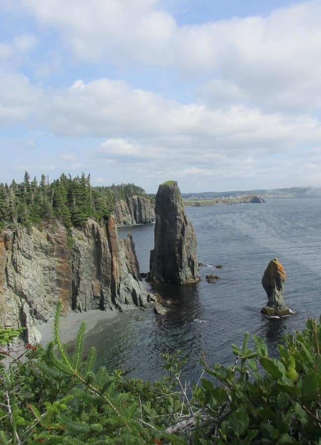
The Skerwink Trail is generally considered by many to be the best hiking trail in Newfoundland, and I don’t disagree. This very popular hiking trail was very busy during my weekday visit. A coastal trail where you can see sea stacks and rugged cliffs from several viewpoints along the rugged cliffs.
One description says you might see icebergs and/or whales, but during our summer visit, I had no luck. However, we did see whales and puffins along a nearby trail later.
This trail is for everyone, and I saw plenty of kids, a few dogs (must be on a leash), couples, individual hikers, and hiking groups. Some people from the area even run the route.
It was foggy in parts with a slight mist and very windy, so I recommend bringing a jacket. Also, I suggest hiking boots as it is rocky, although many seemed to just be wearing running shoes. Easy to follow the trail with many viewpoints, stairs, and before dropping down to the water level at the end. A must-do.
Skerwink Trail Details and Information (Rated: 4.8 / 5.0)
Location: East Trinity on the Bonavista Peninsula. AllTrails maps to the Skerwink Trailhead.
Length: 5.3 km loop trail
Elevation Gain: 62 metres
Difficulty: Moderate due to many stairs, steep sections, and uneven terrain
Cost: None
5. Spillars Cove Trail
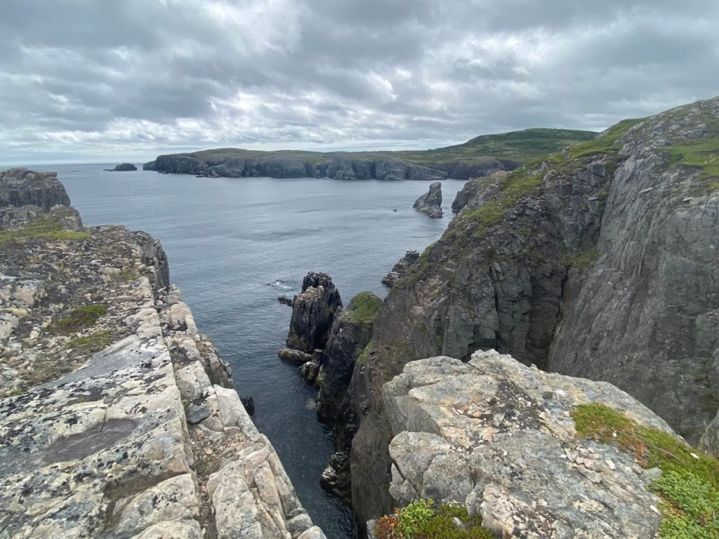
I walked from the parking lot along the spectacular coast, with the highlight being the sea stacks and views over the North Atlantic Ocean. Puffin colonies are also on the peninsula, and hikers sometimes see whales, although I didn’t.
I went to the wrong parking lot and ended up doing the connecting Klondike trail from the small village of Ellison through the woods until reaching the Spillars Cove Trail. Added 6.3 km to the walk.
Spillars Cove Trail Details and Information (Rated: 4.7 / 5.0)
Location: Bonavista. AllTrails map to Spillars Cove Trailhead
Length: 3.4 km out and back. Connects with the Klondike Trail
Elevation: 45 meters
Difficulty: Moderate
Cost: None
Insider Tip: Make a day out of it. After your hike, head south of Elliston to the well-signed parking lot, where it is a short walk to see the Puffin Colony (privately owned, donations accepted). I was very busy during my visit.
Then head a bit north to the viewing platform to see the arch at Dungeon Provincial Park, a UNESCO Geosite.
6. Terra Nova Coastal Trail

Other trails in Terra Nova National Park are rated higher, but this remains one of the most popular. You can start from the Discovery Centre parking lot or Newman Sound Campground. Either way, do go to the Visitor Centre as the exhibits are a bit unique, as you have the opportunity to touch the starfish and others.
The easy main trail follows along the coast with a few moderate climbs and nice views. Expect some stairs, boardwalks, roots, and sections along the beach.
If looking for something more challenging, check out the nearby 15 km Damnable Trail System.
Terra Nova Coastal Trail Details and Information (4.2 / 5.0)
Location: Terra Nova National Park. AllTrails maps to Terra Nova trailheads.
Length: 9.5 km return
Elevation Gain: 81 metres
Difficulty: Easy to moderate
Cost: Parks Canada fee or Discovery Pass
7. Gros Morne Mountain (James Callaghan Trail)
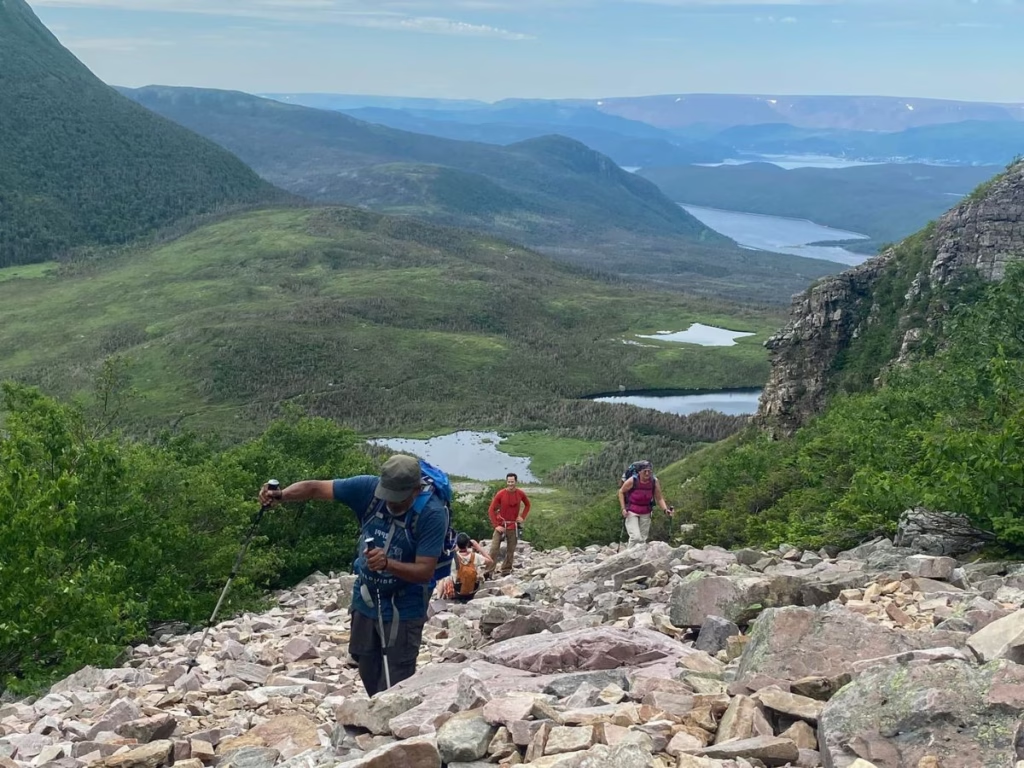
The first thing I noticed when I drove into the large parking lot (other than it was very full) was all the warning signs at the trailhead. Gros Morne Mountain is the highest in the park and the second highest in Newfoundland, and I had heard the stories of some who run into difficulty.
For a more moderate walk, many hikers just walk the 9.2 km in and out base trail with a gradual climb with loose rocks with 463 metres of elevation, but you still get some amazing views.
If tackling Gros Morne Mountain, expect steep climbs, a long distance, but amazing views of the deep fjords once you reach the top. The best option is to hike the mountain clockwise. High winds and fog are not uncommon. And in our case, there was a moose also walking on the trail.
Insider Tip: As I spent 4 nights at Gros Morne National Park I also hiked other trails, including the Bakers Brooke Trail, which offers a stunning waterfall. If you don’t want to do Gros Morne Mountain, this is a great alternative.
Gros Morne Mountain Trail Details and Information (Rated: 4.8 / 5.0)
Location: Gros Morne National Park on the West Coast of Newfoundland, open June 28 to late October. AllTrails maps to the Gros Morne Mountain Trailhead
Length: 16.9 km loop trail, so you should start early morning
Elevation Gain: 1,000 metres
Difficulty: Challenging
Cost: Parks Canada daily fee or Discovery Pass
Where to stay during your Gros Morne Mountain or Tablelands hikes.
8. Tablelands Trail

This short trail is so different looking, almost like the surface of Mars, barren with rocks and only a few trees, and a bright orange surface. I took the Parks Canada guided walk at 10 a.m., which operates most days, to learn a little more about the area.
The trail is easy to follow, and there are some boardwalks as it goes along the base of a mountain. There are further boardwalks towards the end, where it heads along a small stream in the glacially carved Winter House Brook Canyon to the observation deck.
It was crowded the day I was there, as this is a trail everyone wants to walk because it is so unique. I don’t agree with the low rating, as although it is very easy, it is also very unique and unlike any other trail I have been on in Canada.
Tablelands Trail Details and Information (Rated: 4.5 / 5.0)
Location: Gros Morne National Park. AllTrails maps to the Tablelands Trailhead
Length: 4 km in and out trail
Elevation Gain: 88 metres
Difficulty: Easy
Cost: Parks Canada daily fee or Discovery Pass
Insider Tip: You may not want to drive the 366 km (ow) to St. Anthony, but I did. On the east end of town are 3 very short trails with lots of stairs, a boardwalk, scenic views of Iceberg Alley, a nice restaurant,t and a lighthouse.
I also went to the nearby UNESCO World Heritage Site of L’Anse Aux Meadows with the Viking settlement, the earliest known European settlement. There is also an easy 2.4 km hiking trail along the shore.
9. Erin Mountain Trail
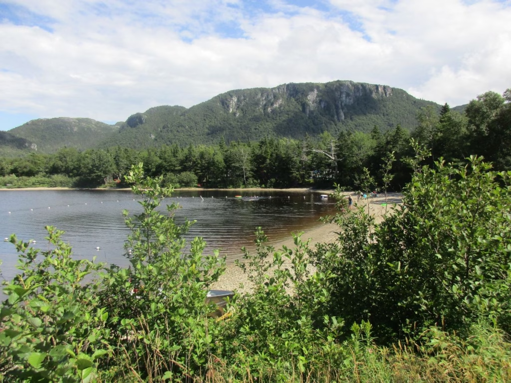
I was looking for a campground in a location where I could easily catch the Marine Atlantic ferry from Port aux Basques the next day. So, I booked a site in Barachois Pond Provincial Park, which is on Highway 1 in southwest Newfoundland.
The small campground is along Barachois Pond (really a small lake) with the Erin Mountain trailhead at one end and within walking distance of my campsite. One report stated you may see moose along the trail, but I saw one right along the camp road before I even started.
The first section is over a stream and along boardwalks. I then walked through a forested area, climbing to the lower lookout. The next section through the forest and over rocks is a bit steeper and challenging until reaching the top for superb views of the area, including the Long Mountains.
A bonus when I returned was watching the sunset over the pond. Some hikers have reported that the trail can be very slippery following rain.
Erin Mountain Trail Details and Information (Rated: 4.4 / 5.0)
Location: Barachois Pond Provincial Park. AllTrails map to Erin Mountain Trailhead
Length: 7.1 km out-and-back trail
Elevation Gain: 319 meters
Difficulty: Moderate
Cost: Newfoundland Provincial Park vehicle fee
How to Get To Newfoundland

If flying for hiking along the Avalon Peninsula, the East Coast Trail, or the Bonavista Peninsula, fly into St. John’s, and Skyscanner can help. If exploring Western Newfoundland, including Corner Brook, Gros Morne National Park, or St. Anthony’s, fly into Deer Lake. Gander Airport, midway across the island, offers some flights.
I took the Marine Atlantic ferry from North Sydney, Nova Scotia, with limited service to Argentia and daily service to Port Aux Basques. I did some hiking in Cape Breton on the way home.
What to Bring While Hiking in Newfoundland
Hiking Boots – to support you over the rocky trails
Hiking Poles – for support while walking the trails
Rain Poncho – expect rain while in Newfoundland
Water Bottle – keep hydrated while hiking
Sunglasses – from Beacool
FAQ’s: Newfoundland Trails
From June 19 to September 7, 2026, the Canada Strong Pass provides free or discounted admission to Canadian National Parks, historic Sites, camping sites, Museums, and VIA Rail.
Discovery Pass: I purchased an annual Parks Canada Discovery Pass, which provides entrance to all National Parks and National Historic sites, which was a money saver.
Best Time to Visit: From May to September. If visiting in early summer, you are more likely to see icebergs as well.
Where to stay: many accommodations (including campgrounds, B&Bs) are only open during the summer season and are limited, so reserve in advance at booking.com.
Cell Phone Service: can be limited in some regions, depending on your service provider
Final Thoughts on Newfoundland Hiking
During my visit, I hiked additional trails not listed here and found the Hikes of Eastern Newfoundland and the Hikes of Western Newfoundland books available on Amazon to be valuable in my planning.
What I loved about Newfoundland Hiking was the variety of trails, the lighthouses, the sea stacks, and the scenic coastline. Yes, I did see puffins, magnificent humpback whales, and minke whales from the shore.


