

Looking for the best experience in Gros Morne?
You’ve certainly come to the right place because I’ve been fortunate to be able to fully explore the park. As an experienced traveller across Canada, Gros Morne and Newfoundland had always been on my must-do list.
This helpful guide on the best things to do in Gros Morne National Park lets you get the most from your visit. There is so much to see that you need to plan your visit.

A UNESCO World Heritage Site since 1987, with fjords, a spectacular coastline, lakes, waterfalls, ancient mountains, geological wonders, barrens, lighthouses, and numerous hiking trails on the West Coast of Newfoundland. My 4-night stay was far too short, and I recommend a longer stay.
With this list of the best things to do in Gros Morne National Park, you can get the most out of your visit to this large 1805-square-kilometer park. This list of activities goes from north to south in the park.
1. Cows Head
Location: north end of the park
Highlights: theatre, Cows Head Lighthouse trail, and nearby beach
Driving the Viking Trail (Highway 430), exit for a bit of a drive into the village of Cow Head. French fishermen called the area “Tete de Vache,” meaning the head of a cow in English, as there is a large rock that resembles a cow’s head when seen from the sea. There are some restaurants, accommodations, and the Gros Morne Theatre Festival with live plays and musical events.
From the main street of town, the short 2 km (return) trail to the Cows Head Lighthouse, built in 1909, wanders through meadows and along the coast with views of the Long Range Mountains. Watch for whales.
2. Shallow Bay Campground
Location: the northern part of Gros Morne
Highlights: campground with a 4 km beach, so great for families, Old Mail Trail
Adjoining the town of Cow Head is Shallow Bay Beach, one of the few places in the park with a sandy beach. Facilities include a picnic area, kitchen shelter, and playground. Washrooms with change rooms. A great place for the kids.
The campground features 11 serviced sites, 45 unserviced sites, 2 oTENTiks, and 4 small cabins surrounded by an evergreen forest. The Old Mail Road trail is 2 km return and follows the route used in the past to deliver the mail while walking through forests and past sand dunes.
3. Broom Point Fishing Premises
Location: north end of the park between Western Brook Pond and Cows Head
Highlights: traditional fishing premises and hiking trail
Note: premises were closed for renovations in 2023
Take the easy 1 km Steves Trail to the Broom Point Fishing Premises, a place the three Mudge brothers and their families called a“summer home” from 1941 to 1975 as they fished this coastline. You may wish to combine Broom Point with the Western Brook Day Use Area just to the south. It has a sandy beach and a picnic area next to a babbling brook.
4. Western Brook Pond

Location: In the Northern part of Gros Morne
Highlights: short hike followed by a boat trip into the fjord
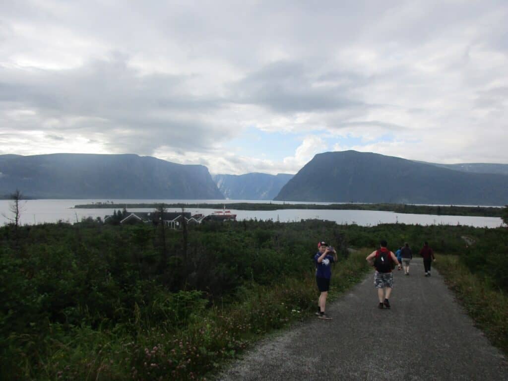
A drive of 30 km north of the Berry Hill Campground or slightly more from Rocky Harbour brings you to the huge parking lot on the east side of Highway 430. Allow one hour from the parking lot for the 3 km easy walk across a coastal bog with plenty of wildflowers. There are a few benches, lookouts, and a short side trail to Western Brook.
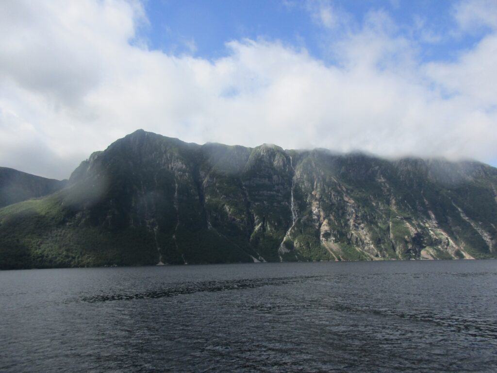
Upon reaching the cafe, you can purchase a coffee or a snack while waiting for your boat trip. There are washrooms and a platform where you can view Western Brook and the mountains. The 2-hour Western Brook Pond boat tour is a must as you travel down the length of the freshwater fjord surrounded by sheer 700-meter cliffs and the mountains. The captain provides a commentary and mentions that they sometimes see wildlife on the shore. Expect to be awed.
There may be a short stop only to let off overnight hikers (with permits) attempting the long-distance walk.
Insider Tip: Book this boat tour in advance, as the ticket office is about 3 km from the parking lot, and you want to avoid the disappointment of finding it full. I found that by booking the 10 a.m. boat tour in the morning, it was not as crowded.
5. Long Range Plateau North Rim Hike
Location: Western Brook Pond
Highlights: primitive camping, hiking to the North Rim
Note: Difficult hike, and requires a permit for camping. Provides access to the North Rim Traverse and Long Range Traverse
This is only for experienced hikers, as you take a side trail from the Western Brook Pond route to Snug Harbour, or the boat tour can leave you at the end of the fjord. Camp on the shores of Western Brook Pond in a primitive campsite.
Then follow the North Rim access route and ascend 600 meters to the top of the Long Range Plateau for this backcountry hike, which takes several days. You will need a map/compass or GPS. Your reward is one of the most amazing views in the park, the one you see on all the posters.
6. Green Point Geological Site & Campground

Location: central Gros Morne, 12 km north of Rocky Harbour on Highway 430. Separate entrances for campground and geological site
Highlights: layered rocks with fossils
As I arrived and drove towards the parking lot, another car was waving at me and pointing to a moose beside the road. Best to visit at low tide as you walk over a rocky beach to see the layered rocks of the former ocean bottom.
The Green Point Campground is just south of the geological site with a separate entrance and is known for spectacular sunsets and coastal views. The campground features 8 serviced sites, 23 unserviced sites, 2 oTENTiks, and a dog park. The only campground open year-round. The north trailhead of the Coastal Trail can be found here.
7. Coastal Trail
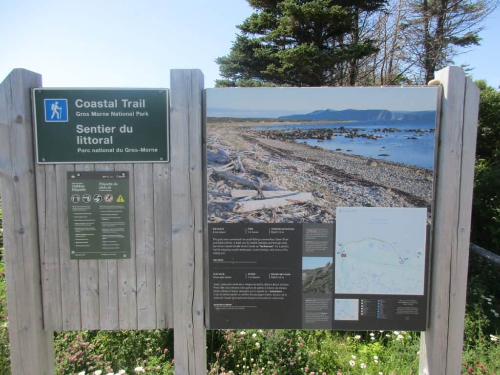
Location: Gros Morne Central, just north of Rocky Harbour. Best to use the parking lot on the west side of Hwy 430 next to Bakers Brook and walk towards the campground
Length: easy 6 km return
Highlights: coastal views, picnic beside Bakers Brook
The coastal trail starts along Bakers Brook and into the forest, eventually following the scenic coast for 3 km to Green Point. The trail ends at the Green Point Campground in Gros Morne.
AllTrails can feature route maps of this and all the park trails.
8. Berry Head Pond Trail
Location: the central part of the park near Rocky Harbour
Highlights: easy 2 km trail with the first 350 meters wheelchair accessible
This is the only trail in the park that is wheelchair accessible, although only for the first 350 meters, with the rest a narrow path. It loops around a pond.
9. Bakers Brook Falls Trail
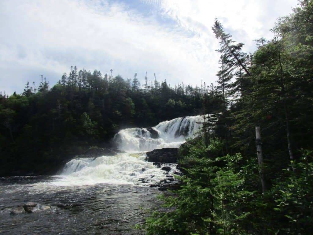
Location: drive up the entrance to Berry Hill Campground a fair distance, and you will see the parking lot on your left
Highlights: unique interpretive signs, 3 cascading waterfalls
Length: moderate 10 km return
A very popular trail, at least on the day I hiked it. From the parking lot, you start with a series of boardwalks across some bogs. Do take the first side trail, which loops to a lookout with views of a small pond and the mountains. Sidetrail 2 is the moose experience, where you walk through an area largely stripped of vegetation and then enter a fenced area with lush vegetation and signs explaining how much the moose eat.
Still fairly flat as I continued with lots of wildflowers and strawberries (surprised the other hikers had left them). The trail gets a bit muddy as I reach the river and the view of the first cascade. Then two sets of stairs with a second view of the falls (the best view), with a platform and bench. And finally, more steep steps to the third viewpoint, which is more restricted. There are benches and washrooms at the falls. Return the way you came.
10. Berry Hill Pond Trail

Location: same parking lot as Baker’s Brooks Falls and several locations in the campground
Highlights: views of the pond
Length: 2 km easy loop
An easy loop around a pond known as a home for beavers. During our stay, parts of this trail were flooded, but it was still passable.
11. Berry Hill Campground

Location: near the center of the park and 5 km north of Rocky Harbour, but with a long drive to the park office
Highlights: close to 3 hiking trails, Gros Morne Mountain, and Rocky Harbour
If you are a hiker, this is where you want to stay, as it is close to the town and some of the main hiking trails. Includes 25 good-sized serviced sites, 41 unserviced sites, 3 oTENTiks, 6 rustic cabins, and a group camping area all in a forested setting.
This is where I stayed, and I witnessed others staying at other campgrounds asking the Parks Canada staff to move here from other campgrounds, as it is close to the best trails. It is generally one of the first to sell out.
12. Lobster Cove Head Lighthouse

Location: 3 km north of Rocky Harbour
Highlight: best place to see sunsets in the park, historic lighthouse, signs, and Parks Canada staff to explain history
Interesting visit to the Lighthouse because the Parks Canada staff were really into the history of Lobster Cove Head, and they sure liked to talk about the place. For example, Chloe explained that they changed the flags outside every day, and they actually signaled a message; try to figure it out on the day of your visit. On the other side were some short trails on the grounds, while the views of the coast were splendid, and this location is known for its sunsets.
13. Rocky Harbour

Location: middle of the park
Highlights: shops, gas station, restaurants, accommodation, Visitor Center, swimming pool (fee)
Rocky Harbour is a small village along the Atlantic coast and the biggest community in the park, having an indoor pool, a good general store, a convenience store, Home Hardware, gas stations, a pharmacy, and a Bank of Montreal. Easy to walk along the waterfront with its hotels, a hostel, galleries, a liquor store, the Gros Morne Wildlife Museum, and the Parks Canada Gros Morne Visitor Centre. Restaurants include Fisherman’s Landing and Oceans Dining Room.
Insider Tip: When entering Rocky Harbour, drive down to the waterfront, turn left, and follow the road to the end, where there is a wonderful store with fresh seafood.
14. Gros Morne Mountain Trail

Location: middle of the park, just south of Rocky Harbour on Highway 430
Highlights: the views from the top of Gros Morne Mountain
Length: Approach Trail of 9 km rated moderate plus Summit Trail of 8 km rated difficult for a total of 17 km. A shorter option than the Approach Trail is also available.
The Approach Trail follows Crow Gulch Brook with some waterfalls. For an even shorter hike, just go to the bridge overlooking a waterfall halfway along the trail. Those with a good fitness level can continue the steepest and hardest part of the trail. We had a moose follow us on the trail. The summit with an elevation gain of 1000 meters can be exposed to extreme weather, so take care. Once you arrive, it is safer to hike the mountain loop clockwise. You will be rewarded with great views.
15. Norris Point

Norris Point is another town in the central part of the park, with hotels, B&Bs, small stores, and restaurants. My friends and I got a table on the deck of the Cat Stop Pub and Grub, and that is where the locals go, as they mentioned after joining us at our table. The menu is limited, and the service is slow, but sitting on the deck in the sun with the incredible views of Bonne Bay is worth it.
The Bonne Bay Marine Station and Aquarium is located there, as is the ferry across the water to Woody Point and the Gros Morne Discovery Centre. As we enjoyed our drinks, we saw a steady stream of people heading for the ferry.
16. Mattie Mitchell Site
A short 250-meter loop to learn about Mattie Mitchell, a Mi’kmaw guide of their culture.
17. Southeast Brook Falls Trail
Location: First trail along Highway 430 after entering the park
Highlights: waterfalls
Length: 700 metres return
A short trail to view the waterfalls plunging 40 meters over a ridge.
18. Lomond Campground & Trails
Location: 17 km after entering the park, take Highway 431
Highlights: views of Bonne Bay and the mountains, picnic area, campground, 3 hiking trails
The Lomond Campground offers 26 unserviced sites, 6 unserviced beach sites, and a playground. Once upon a time, it was the site of a logging community. There is additional camping at primitive sites at Stanleyville.
The Lomond River Trail is a moderate 6 km hike through the Lomond River Valley and is known for the orchids that can be found along the route in June and July. The Stanleyville Trail is only a 4 km moderate hike, but it is along a historic path to an abandoned town and Paynes Cove. From the same parking lot as the Lomond River trail, you can head in the opposite direction on the 9.5 km moderate Stuckless Pond Trail along an old logging road before circling the pond.
19. Gros Morne Discovery Centre

Location: Take Highway 431 towards Woody Point, and you will see it on your right
Highlights: exhibits, cafe, and trailhead for the
The Gros Morne Discovery Centre is located on the side of a hill with great views of the countryside, including the Tablelands in the distance. Do check out the gift shop, exhibits, and 19-minute film, learn about the Mi’kmaw people, and enjoy a coffee, and in my case, served with a great muffin.
20. Lookout Trail

Location: the trailhead is at the Discovery Centre
Highlights: even better views of the park than you get from the Discovery Centre
Length: 5 km moderate loop
I didn’t hike the Lookout Hills trail myself (I should have), but my friends raved about what a short but great hike it was. From the Discovery Centre, you climb over 300 meters to a plateau for a panoramic view of the park. There is a loop around Partridge Berry Hill at the top with the viewing platform. To the north, you can see Woody Point and Bonne Bay, and in the other direction, the Tablelands.
21. Tablelands Trail & Guided Hike

Location: The parking lot is a few kilometers just past the Discovery Centre on your left
Highlights: very unique landscape, guided hike
Length: 4 km return, listed as one hour, but if taking the guided hike, double the time
I arrived at 10 a.m. for the Parks Canada guided hike (free), as had a lot of other people. The staff then divided us into two groups, one with an English-speaking guide and another with a French-speaking guide. The groups then set off separately as the guides explained the history of this red landscape that to me looks like the surface of Mars. There were frequent stops to point out various features and plants, with the final one being a boardwalk along a stream flowing from the hills. Return to the parking lot on the same route on your own.
21. Green Gardens Hike
Location: Continue on Highway 431 past the Tablelands until reaching Green Gardens on your right. There are several places to start with Long Pond being the most popular
Highlights: coastal cliffs, sea stacks
Length: 9 km moderate hike
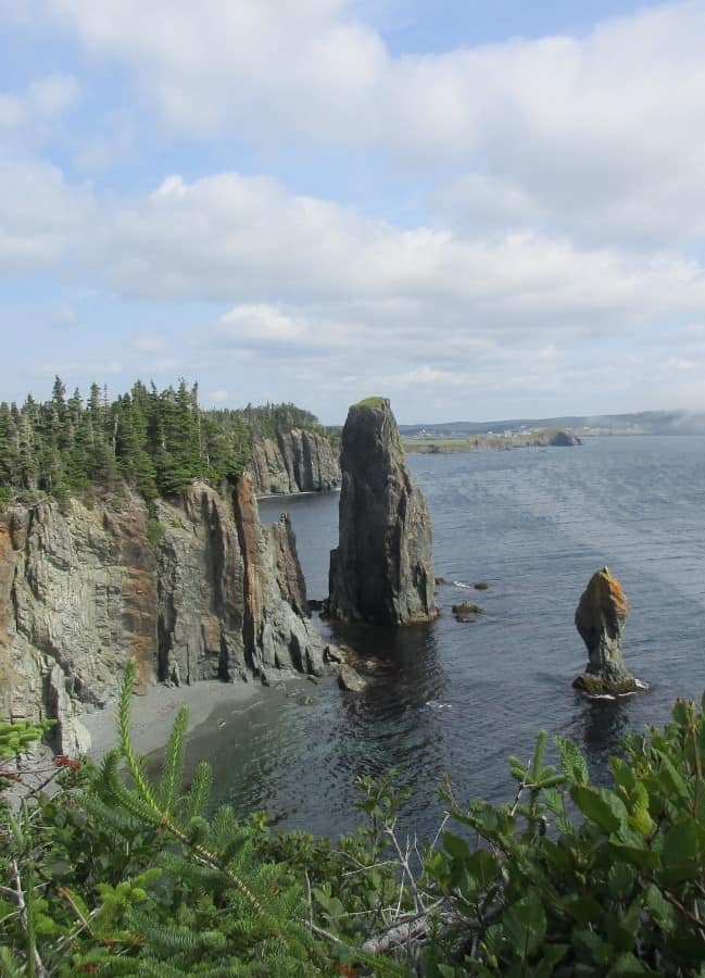
Located in an area of the park also including the Tablelands, known as the Gulch. Starting from the parking lot on the Green Gardens trail, you head through a barren landscape before reaching the coast to view the cliffs and sea stacks. Wallace Brook is 3 km longer than the Long Pond route.
22. Trout River Campground & Hike
Location: At the end of Highway 431 next to Trout River Pond
Highlight: views
The fishing village of Trout River has an oceanfront boardwalk and the Humic and Eastern Point community trails with great views. Meanwhile, the Old Man/Lighthouse trail leads to some interesting rock formations and provides views of the town from the other side of Feeder Bridge.
In the park, the Trout River Campground offers 34 unserviced sites, 2 oTENTiks and 4 tiny cabins. The Trout River Pond hike is a moderate trail following the shore for 14 km (return) with views of cliffs, the “Narrows” wildflowers, and the Tablelands.
23. Overfalls Trail
Location: at the end of Trout River Pond
Highlights: waterfalls, views of Trout River Pond
Length: 10 km, rated difficult
First, you will need to arrange for a one-hour boat transfer (and return) up Trout River Pond. Then you hike up a narrow trail that takes you to the base of Overfalls and leads you to the top of a hill for amazing views of the Tablelands, Overfalls, and Trout River Pond
Park Accommodations
There are 5 campgrounds spread throughout Gros Morne National Park offering both serviced and unserviced sites, oTENTiks, and some with small cabins. There is also the Norris Point KOA Campground on Highway 431 near the park entrance.
Gros Morne National Park camping also has primitive sites in four locations, including:
- Stanleyville – 2 km hike or paddle to sites on Bonne Bay
- Green Gardens – 4.5 km hike to sites overlooking coastline
- Ferry Gulch – 8 km hike up to Ferry Gulch via Gros Morne Approach Trail
- Snug Harbour – 8 km hike to the shores of Western Brook
Rocky Harbour is the main town with hotels, B&Bs, and a hostel. I like the location of the Ocean View Hotel, right in the center of town, with many motorcoach tours using it during my visit. The Fish Sheds on the edge of town offer popular cottages.
The Out East Adventure Centre Hostel has locations in both Rocky Harbour and Norris Point. I talked with a guest staying there during my visit, and they thought highly of the place.
Trout River in the south has housekeeping cottages, an RV park, a motel, and a lodge. Cow Head in the North offers B&Bs and a motel.
My suggestions for Gros Morne National Park accommodation in Rocky Harbour, Norris Point, Cow Head, and Woody Point, and which town is best to use as a base.
Parks Canada Fees
From June 19 to September 7, 2026, the Canada Strong Pass provides free or discounted admission to Canadian National Parks, historic Sites, camping sites, Museums, and VIA Rail.
A Park Pass is required for all activities in the national park. Parks Canada Discovery Pass provides the best value, but click here to check out all the available passes and permits.
Sample 4 Day Gros Morne National Park Itinerary
In no particular order, you will want to do these activities.
Day 1 – Hike Gros Morne Mountain, or alternatively, Bakers Brook Falls, afterward drinks at Cat Club in Norris Point
Day 2 – Western Brook Pond boat trip and visit to Lobster Cove Head Lighthouse and Rocky Harbour on return
Day 3 – Drive to the south end of the park for the 10 a.m. Tablelands Guided Hike, Discovery Centre, and either Lookout Trail or Green Gardens
Day 4 – Depends on your interests. Go swimming at Shallow Bay or hike one of the other trails
How to Get to Gros Morne National Park
Many people doing an Eastern Canada road trip include Newfoundland and Gros Morne. From St. John’s, it is a 665 km drive on the Trans Canada Highway until you reach Deer Lake, where you exit onto Highway 430, which takes you to the park entrance. Discover Cars offers rental vehicles.
Another way is in Atlantic Canada: go to North Sydney in Nova Scotia and take the Marine Atlantic ferry to Port aux Basques, Newfoundland. Then it is an easy drive on the Trans Canada Highway to Deer Lake, connecting with Highway 430 (Viking Trail Route) to Gros Morne.
The closest airport is in Deer Lake. DRL offers one daily bus from St. John’s to Port aux Basques with numerous stops. There is a taxi service available in the park.
Newfoundland North Coast Self-Drive Tour – from St. John’s along the North Coast with plenty of time in Gros Morne, including 13 nights of accommodation, car, Western Brook Fjord cruise, Iceberg cruise, and much more.
What to Bring for Your Gros Morne Hiking
✅ Backpack – to carry your lunch and other items while hiking.
✅ Hiking Boots – as the terrain can be rugged, particularly Gros Morne Mountain
✅ Hiking Poles – to assist you while hiking
✅ Rain Poncho – as you can expect rain at times
✅ Water bottle – stay hydrated with this bottle with purifier filters
FAQs: Gros Morne National Park Things to Do
How many days do you need in Gros Morne?
A minimum of 3 to 4 days to take the Western Brook Pond boat trip into the fjord, hike the Tablelands, hike Gros Morne Mountain, and another day for the various other hiking trails, beaches, and museums.
Is Gros Morne worth visiting?
Yes, not only because it is a UNESCO World Heritage site, but it has awesome scenery, some of the best hiking trails in Canada for all levels, a boat trip up a fjord, and great seafood restaurants.
Can you swim Gros Morne?
Yes, there are several beaches, including the 4 km sand Shallow Bay Beach next to the campground. There are several other smaller beaches, including the Western Brook Pond Day Area.
Can you hike Gros Morne without a guide?
Yes, most hikers do not use a guide on any of the 20 trails in the park, including Gros Morne Mountain. Be sure you check the rules and that you have the right fitness level for the trail, and then just follow the trail.
When is the best time to visit Gros Morne?
Anytime, between late May and mid-October. In May, you may see some icebergs offshore. If planning on hiking Gros Morne Mountain, it is closed to hiking in May and June for ecological reasons.
Looking for information on other Canadian National Parks?
- In Ontario, visit Point Pelee National Park, the southernmost point in Canada
- Prince Edward Island National Park walking trails
- And other scenic hiking trails throughout Newfoundland
Wrap-up: Best Things to Do in Gros Morne National Park
Gros Morne National Park is a UNESCO World Heritage site with striking scenery, beaches, boat tours, wildlife, and many activities, including some of the best hiking in Canada.