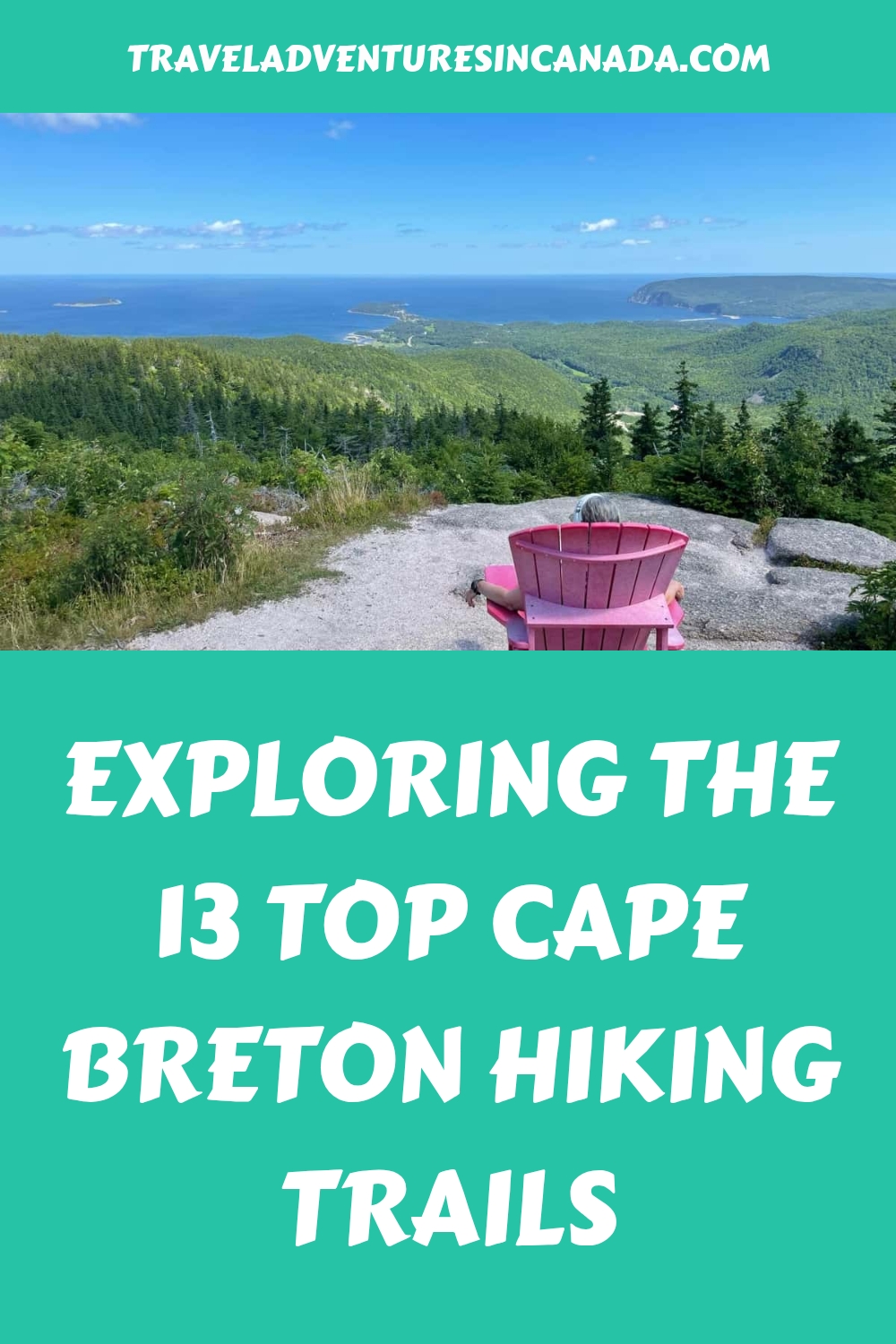


Do you want to know more about the top Cape Breton Hiking Trails?
Well, I did, and along with a few friends, spent days checking out the best trails.
Like a lot of people, my first visit to the island was a drive to North Sydney for the Maine Atlantic ferry to Newfoundland, where I hiked the East Coast Trail, Skerwink Trail, and in Gros Morne National Park.
On my return, I had planned to check out Cape Breton Island. Much of the island is part of Cape Breton Highlands National Park, so my first few trails are in the park along the famous Cabot Trail. But there are other trails, perhaps not as well known, that I wanted to check out on the rest of the island.
Cape Breton Highlands National Park Hiking Trails
From June 19 to September 7, 2026, the Canada Strong Pass provides free or discounted admission to Canadian National Parks, historic Sites, camping sites, Museums, and VIA Rail.
There are 26 hiking trails in Cape Breton Highlands National Park, and these are some of the best. They include a variety of lengths, terrain, difficulty, and what you can expect to see. AllTrails can help plan your hiking with detailed route maps.
The Chéticamp Visitor Centre features exhibits and offers the guided Salmon Pools Walk in July and August, plus night hikes. The Ingonish Visitor Centre offers detailed information and is next to the Freshwater Lake look-off with stunning views of the rugged coastline.
1. Skyline Trail

Trail length: 7 or 8.7 km loop, takes about 2-3 hours
Elevation gain: 290 to 405 metres
Difficulty: Rated easy and suitable for everyone, but be aware that there are 263 stairs at the viewing platform
Trailhead location: On the Cabot Trail along the west coast at the top of French Mountain
When I mentioned the Best hikes in Cape Breton, everyone mentioned the Skyline Trail, so it was first on my list. As it is so popular, the Skyline Trail can be crowded at times, so it is best if you can arrive early in the day, before 11 a.m., or you may find the parking lot full. It is more of a walking trail than a hiking trail, as it is a wide, flat trail at least until you reach the viewing platform, where there are some steps.
Despite the crowds, the breathtaking views of the Atlantic Ocean will make it all worthwhile. Besides the great ocean views, you may see a whale, and along the way, people have seen bears and moose.
Further information on the Skyline Trail can be found on the Parks Canada website.
Effective 2026
To help improve the visitor experience and protect the integrity of the Skyline Trail, a timed parking reservation system will be implemented from June 26 to October 25, 2026.
2. Franey Trail
Trail length: 7.4 km loop taking 2 – 3 hours
Elevation gain: 363 metres
Difficulty: Difficult, as it involves a steep climb
Trailhead location: Turn off the Cabot Trail just north of the Clyburn River (near Ingonish Centre) and follow a fire access road for about a kilometre to the small parking lot.
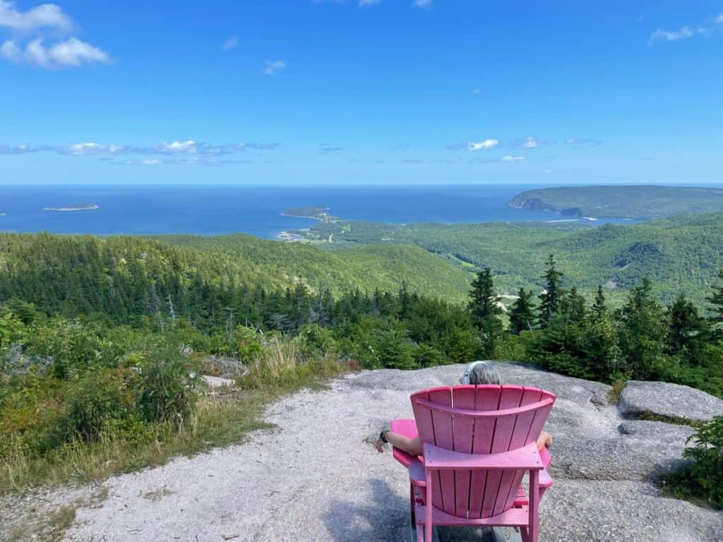
Another very popular one, so arrive early, but this is one of the more difficult hikes. If you go counterclockwise, it takes longer but is not as steep as heading to the left. Along the route, expect rugged sections with tree roots, rocks, and stairs. In other parts, it is flatter, and you are walking beside streams, and there is a section more like a logging road as well.
However, the panoramic view at the end from the two lookouts is simply beautiful and absolutely worth the effort, as you can see the coast from Cape Smokey to Ingonish.
Further information on the Franey Trail may be found on the Cape Breton Highlands National Park website.
3. Acadian Trail

Trail length: 8.4 km loop, taking just over 3 – 4 hours to complete
Elevation gain: 418 metres
Difficulty: Moderate
Trailhead location: Opposite the Chéticamp visitor centre on the west side of the park
Also, one of the best hikes to do in the park, I started the trail counter-clockwise on the forest path so that I was facing the many cascades in the stream, and it is easier walking, although you are on a steady incline. That way, when you descend on the return on the rocky path, it is not as challenging.
Like many of the other trails in the park, you are rewarded with several viewpoints (5 along the entire trail) of the coastline, ocean, and Cheticamp. The red chair at the very top lookout is a good photo opportunity. You could see some moose or bears along this route.
Further details on the Acadian Loop Trail can be found on the Parks Canada website.
4. Middle Head Trail

Trail length: 4.5 km loop, taking just over one hour
Elevation gain: 141 metres
Difficulty: Moderate, suitable for the entire family
Trailhead location: near Ingonish Centre at 383 Keltic Inn Road
One of the easy strolls along a trail which is mostly flat and with a few short climbs on a coastal headland. There are plenty of lookout points with beautiful vistas, especially good for bird watchers.
There are further details on the Middle Head Trail on the Parks Canada website.
5. Jack Pine and Coastal Trail

Trail length: 2.3 km loop, taking about one hour. Connects with Coastal Trail
Elevation gain: 38 metres
Difficulty: Moderate, suitable for families
Trailhead location: Turn off the Cabot Trail at the Black Brook day-use area near Neils Harbour and turn left to the upper parking lot
The Jack Pine Trail, Cape Breton, was recommended to me by the Parks Canada staff and turned out to be a short hike with moderate elevation gain along a rocky trail with great lookouts and spectacular views of the coast, so take your camera.
The Parks Canada red chair is placed above the waterfalls, always a good spot for a photo.
Further information and trail updates for the Jack Pine and Coastal Trails can be found on the Cape Breton Highlands National Park website.
6. Blueberry Mountain Trail

Trail length: 6.8 km out and back, taking about 3 hours
Elevation gain: 446 metres
Difficulty: Hard
Trailhead location: The trailhead is across the road from the Cape Rouge look-off (which is not marked) along the Cheticamp side of Cabot Trail, where there is a parking lot. Near the Corney Brook Campground.
This is an unmarked trail in the park, but it is still obvious where the route goes. Not as crowded as the Skyline Trail, but with a comparable view. You start from the trailhead by following a stream which connects to the Old Cabot Trail Road. Then, the slow and steady climb to the peak is unbelievably amazing and offers a full 360 view of the surrounding areas. Downhill on the return.
Insider Tip: For all activities in Cape Breton Highlands National Park, you require a pass. I always purchase the Parks Canada Discovery Pass, which allows entry to all parks for one year. Also valid at National Historic Sites such as the Alexander Graham Bell Museum in Baddeck and Louisbourg Fortress, both of which are must-sees in my opinion. In 2026, consider the Strong Canada Pass.
Cape Breton Hiking Trails Outside the Park
7. Cape Smokey Trail

Trail length: posted as 10.6 km out and back, taking 3 to 5 hours. Closer to 12 km
Elevation gain: 363 metres
Difficulty: Moderate
Trailhead location: Cape Smokey Provincial Park along the Cabot Trail just south of Ingonish Beach
From the Cape Smokey Trailhead, a pleasant hike through a pine-forested area, but the trail is not well-maintained by Nova Scotia Parks. However, the final view at the end makes it worth the effort with coastal views of Middle Head and the Keltic Lodge in the distance. One hiker reported that from the second lookout, they saw 33 seals hanging around on the rocks and close to shore.
8. Celtic Shores Coastal Trail

Trail length: 92 km
Elevation gain: mostly flat
Difficulty: easy
Trailhead location: numerous on the southwest coast of Cape Breton
The Celtic Shores Coastal Trail is a rail trail from the Canso Canal to Inverness on the southwest corner of the island. The trail is wide and suitable for cycling and walking, although much of the route is not along the coast but through forests with little to see. Make your choice carefully.
On the second day, I cheated and rode the Celtic Trail on my bicycle. I liked the section around Port Hood the best, as it was next to the coast. Others have said they liked the first 25 km near the Canso Canal for the same reason, but I did not do that section. I also stopped at the Celtic Music Interpretive Centre for lunch.
9. Cape Mabou Highlands Hiking Trails
Trail length: 3.1 km for the Lookoff via Fair Alistair’s from Mabou Post Road Trailhead – but there are other longer routes
Elevation gain: 166 metres
Difficulty: Moderate
Trailhead location: The start of the trail is near the Mabou Post Road Trailhead
There is a series of Cape Mabou Highlands hiking trails. This route involves a steady uphill at the start, but it is really not too steep as you walk through the woods. One of the best Cape Breton hikes offers beautiful views on this short trail.
The Cape Mabou Trail Club does a great job maintaining the trail. Google puts the trailhead at the start of the road, but drive up the dirt road a little further to find the Parking lot.
10. Meat Cove Mountain Trail

Trail length: 3.7 km out and back
Elevation gain: 277 metres
Difficulty: moderate to challenging
Trailhead location: on the north end of the island, turning onto Meat Cove Road, drive along the windy dirt road for just over 11.5km.
The Meat Cove Mountain trail is a somewhat short but very steep and sometimes difficult hill hike that brings you to breathtaking views; however, it is one of the best hikes in Cape Breton. Ropes have been placed alongside the trail to help with some of the steeper sections.
Once you reach the top, there are two options. You can go left up the hill, which brings you higher up with a great 360-degree viewpoint. Or you can go right, which brings you to a view overlooking Meat Cove and St. Margaret’s Bay. It can be somewhat tricky on the descent.
11. Gypsum Mine Lake Trail
Trail length: 2.6 km out and back
Elevation gain: 33 metres
Difficulty: easy
Trailhead location: is just a 5-minute drive from the main street of Cheticamp. Take Cheticamp Back Road, just off the Cabot Trail, with the parking lot right by the Accolade Hostel Retreat Campground.
The gypsum mine trail is a pleasant stroll with a small hill up a former mining railroad bed to the shore of a very pretty lake in the flooded pit of a former mine. To climb the short distance up to the viewpoint up a steep path is a bit more strenuous, but there is a rope to help. Expect to find swimmers at the lake.
12. Uisge Bàn Falls Hike
Trail length: 2.7 km out and back
Elevation gain: 96 meters
Difficulty: Moderate
Trailhead location: Uisge Ban Provincial Park near Baddeck
The access bridge out earlier in 2023 is now open. Do not follow Trailhead GPS listings on Apple/Google Maps, as they take you to a back entrance. Do follow the marked provincial park signs from Old Margaree Road. Short uphill walk with small waterfalls until reaching the main 15-meter waterfalls.
13. Whycocomagh Salt Mountain & Scout Loop

Trail length: 4.2 km loop taking 1 1/2 hours, with a shorter 2.6 km loop available
Elevation gain: 239 metres
Difficulty: Moderate to challenging
Trailhead location: Whycocomagh
Had to mention this hike as staying in Whycocomagh Provincial Park, and the trailhead was right by my campsite. There are two challenging but short hiking trails with superb views of the Bras d’Or Lake. The first 15 minutes along the nice, well-marked trail are straight uphill.
Where to stay on Cape Breton Island

Camping – Nova Scotia has the Mira River near Louisbourg, and I stayed at Whycocomagh near Baddeck, which has a great hiking trail. In Cape Breton Highlands National Park, there are 7 front-country campgrounds, some backcountry sites and oTenTiks which can be difficult to book as they are so popular. There are several private campgrounds, including one at Meat Cove, where I stayed.
On the edge of the National Park, there is accommodation in the villages of Pleasant Bay, Cheticamp and Ingonish, including the well-known Keltic Lodge. Also, there are plenty of options in Baddeck on the Cabot Trail.
Some of the best hotels in Cape Breton, but booking.com can help with others:
What to see in Cape Breton
Although I was mainly on a hiking vacation, I wanted to see some of the local attractions. On the west side of the island, I stopped by the Celtic Music Interpretive Centre while hiking the Celtic Trail. Further along this route is the Red Shoe Inn, owned by one of the Rankin Family, and I took the tour at the Glenora Distillery.
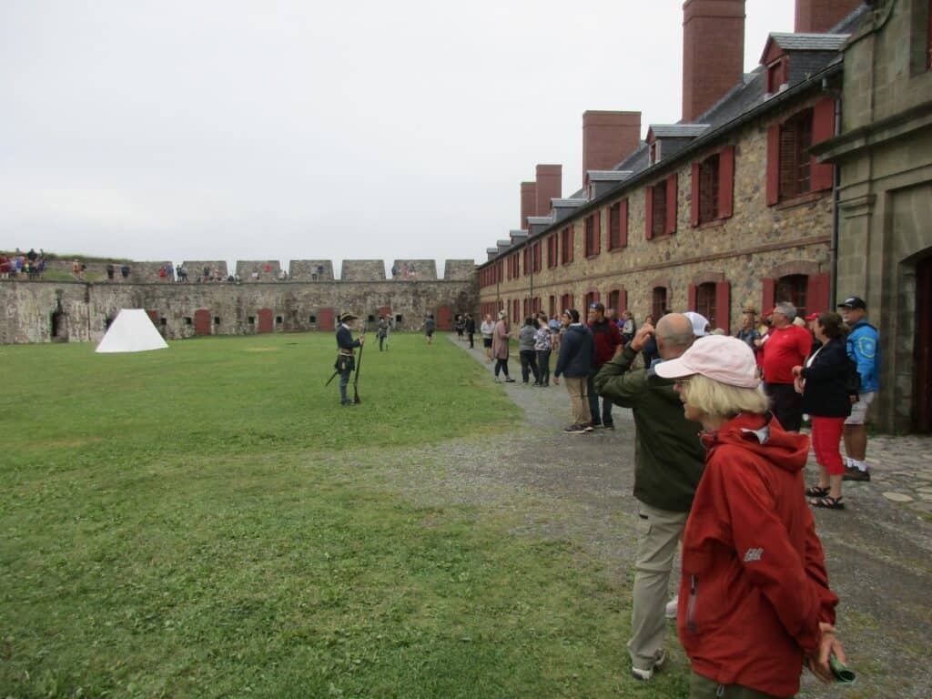
In Baddeck, be sure to visit the Alexander Graham Bell Museum, where your Parks Canada Discovery Pass gets you in for free. Also, using the pass, visit the Fortress Louisbourg National Historic Site, where costumed staff explain how things worked, and you can also witness military drills.
To get the most from your Cape Breton visit, consider:
What to Bring While Hiking
Hiking Boots – for support on the hilly terrain
Hiking Poles – to assist with your walking
Water Bottle – stay hydrated while hiking
Sunglasses – BEACOOL Polarized Sports Sunglasses
Rain Poncho – in case of rain while hiking in Nova Scotia
FAQs: Cape Breton Hiking Trails
When is the best time to go to Cape Breton?
The most popular time is from July to September with pleasant weather.
What is the most difficult hike in Cape Breton?
Franey Mountain in Cape Breton National Park. Outside the park, the Meat Cove Mountain Trail in the north and Salt Mountain further south in Whycocomagh are both short and steep, but with awesome views.
What is the most popular trail on Cape Breton?
The Skyline Trail in Cape Breton Highlands National Park is considered the most popular walking trail. Easy to walk, although there are stairs when you reach the lookout with breathtaking views of the coast.
Want more information on great Canadian hiking?
- Gros Morne hiking is also very popular and should be considered on an Atlantic Canada road trip
- Point Pelee hiking is often along boardwalks crossing wetlands, plus the opportunity to go to the most southern point in Canada
- If you like the trails here, try hiking on the Lake Superior coast in the Ontario Provincial Park
- Some of the best things to do in Pacific Rim National Forest Reserve on Vancouver Island
Final Thoughts: Hiking on Cape Breton Island
Hiking on Cape Breton Island offers everything from simple walks to more challenging mountain hikes. Whichever you choose, expect breathtaking coastal scenery.