
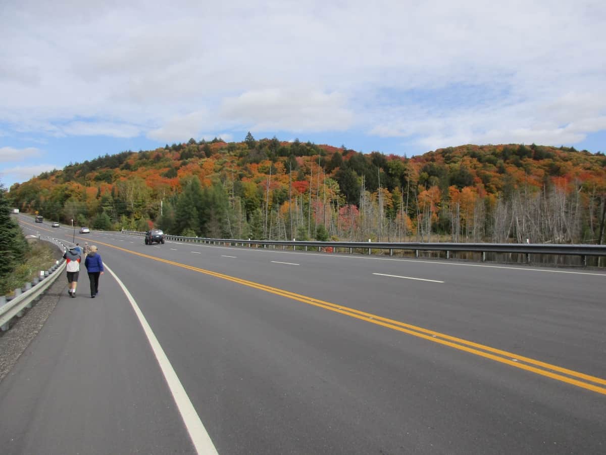

Looking to take a scenic drive in Canada?
Well, you’ve come to the right place, and these are some of the best. While I have not done them all, I usually take the scenic route when I have a choice.
These incredible scenic drives in Canada show off the best we have to offer. Having lived in Canada all my life, I am constantly amazed by the natural scenery we have on display for visitors. This list of road trips starts on the east coast in Newfoundland and heads west to British Columbia before going north to the Yukon.
Use our helpful guide to visit any of these scenic drives. If required, consider using Discover Cars for your trip.
1. Gros Morne National Park

- UNESCO World Heritage Site
- Opportunities for great hiking
- Western Brook Pond cruise through a fjord
- Scenic lighthouses
Starting my list of the best scenic drives in Canada is Gros Morne. Located on the west coast of Newfoundland, Highway 430 connects with the Trans Canada Highway near Deer Lake, and I remember the first part as actually quite flat. Things changed dramatically at the Gros Morne National Park boundary as the road went up and down as it passed through the mountains with views of lakes and the Atlantic Ocean for the 85 km drive through the park, taking about one hour.
Along the way, I passed the famous Gros Mountain with its hiking trail, the town of Rocky Harbour, campgrounds, Western Brook Pond fjord, and finally the town of Cows Head with its beach at the north end. This route is a part of the Viking Trail. I found this scenic drive packs a punch for such a short drive.
2. Viking Trail in Newfoundland

- Arches Provincial Park
- L’Anse aux Meadows National Historic Site (Viking settlement)
- Grenfell Historic Properties in St. Anthony
- Iceberg Alley (June to August) and whale watching
- Fishing villages
Heading north from Gros Morne National Park for the next 330 km, I saw the Atlantic Ocean on my left and the Long Range Mountains on my right for much of the distance. I made a quick stop at Arches Provincial Park and could have stopped at any of the many fishing villages. There were plenty of gas stations along the way, most of which were also convenience stores, and for me, a plus was that they also generally served coffee.
I found the road was good in some places, and in other spots, I was dodging potholes, so you need to keep your eyes open, but there was not a lot of traffic, even during my July visit. At the north end is the town of St. Anthony, the nearby L’Anse aux Meadows National Historic Site, best known for its Viking settlement and viewing spots of Iceberg Alley.
3. Cabot Trail on Cape Breton Island
- Alexander Graham Bell National Historic Site
- 26 hiking trails in the Cape Breton Highlands National Park
- A top golf course at Ingonish
- The traditional Acadian fishing village of Cheticamp
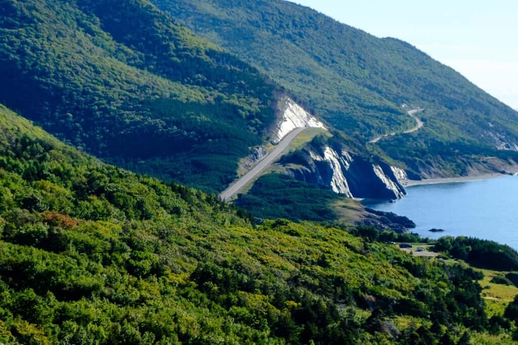
The Cabot Trail goes for a loop around the northern end of the island of Cape Breton in Nova Scotia. For much of its 298 km distance, I was driving through Cape Breton Highlands National Park. It is debatable, but most people feel driving the route counterclockwise is best, so you are in the outside lane closer to the ocean, which I agree.
While you can drive the entire route in one day (5 hours according to the tourist office), why would I want to do that? I did stop in Baddeck for a few hours to see the Alexander Graham Bell National Historic Site. I also wanted to hike the famous Skyline Hiking Trail in the National Park. There are lodges in towns such as Ingonish, but I chose to stop at the Meat Cove Campground at the northern tip of Cape Breton Island.
The Cabot Trail winds a lot with many hills, but I got amazing views. This is a popular route for bicycle touring, and I passed one group along the way.
If you want to leave the driving to someone else, there is a guided Cabot Trail tour available.
4. Lighthouse Trail in Nova Scotia
- Halifax
- Lunenburg UNESCO World Heritage site
- Peggy’s Cove fishing village is best known for its lighthouse
- Over 20 lighthouses
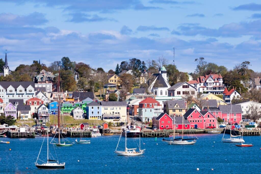
This is a 339 km drive in Nova Scotia from Halifax to Yarmouth. My first stop, like many others, was Peggy’s Cove to see the famous lighthouse with a photo found on so many calendars, and I also took a quick walk through the adjoining fishing village. Then it was down to Chester with its art galleries and shops, with charming Mahone Bay up next.
Lunenburg is a UNESCO World Heritage Site because of the colonial homes from the 18th and 19th centuries and the colourful waterfront, home of the famous Blue Nose found on the Canadian 10-cent coin. I wanted to take the walking tour, visit the shops and restaurants, and also the Fisheries Museum of the Atlantic. Many people only go as far as Lunenburg on a day trip, including myself, but you can continue south along the coast as far as Yarmouth.
5. Fundy Coast of New Brunswick

- Hopewell Rocks Provincial Park
- Fundy National Park
- Fundy Trail Parkway
- City of Saint John
- Saint Andrew
This 330 km route in New Brunswick takes you along the Bay of Fundy to view the highest tides in the world. However, I started at low tide in Hopewell Rocks Provincial Park about 47 km east of Moncton. What made this so special was that I was able to walk on the ocean floor for about 2 km and view the sea stacks, an arch, and some coves.
Further along the coast, I reached Fundy National Park, which offers camping and over 30 hiking trails of varied difficulty and length. As a hiker myself, I loved that many trails had coastal views while others were more in wooded areas with beaver ponds, waterfalls, and streams. As a camper, this is a good spot to stay overnight as well.
A little further still, the next day, I reached Fundy Trail Parkway, a 30 km route that is operated by a non-profit organization. There are numerous trails and lookouts in this park as well. Right next door is the town of St. Martins with covered bridges and red sandstone caves.
After passing through Saint John, I continued to quaint Saint Andrews and the Fundy Islands to complete my coastal drive. There is a full-day tour available from Moncton to the Hopewell Rocks and Fundy National Park.
6. Acadian Trail of New Brunswick
- Giant lobster statue in Shediac
- Kouchibougauc National Park beach and dunes
- Village Historique Acadien, Bertrand
- Miscou Lighthouse
Departing from Bathurst in northern New Brunswick, I headed for the coast and Village Historique Acadien with French and English-speaking interpretive guides on the 2.2 km walking route. Besides the village, there is a hotel, restaurant, and gift shop. The French-speaking peoples of this area, which borders the Gulf of St. Lawrence and Chaleur Bay, are proud of their heritage.
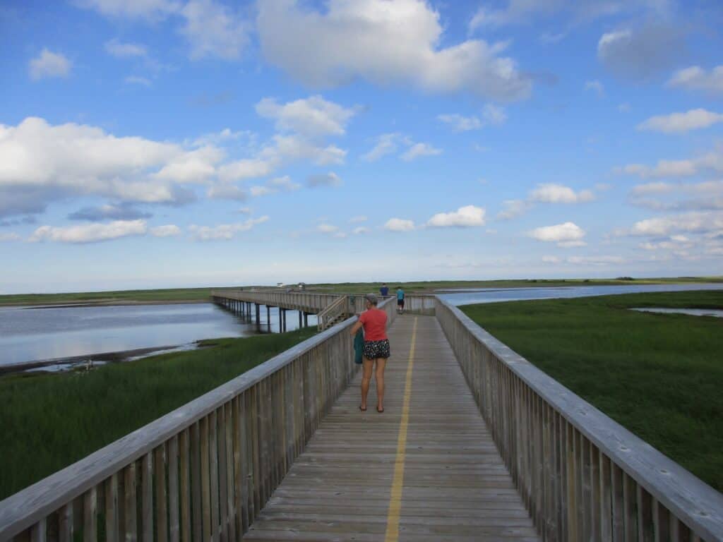
It was a bit of a drive to the island to see Miscou Lighthouse, located on an island with connecting bridges. I stayed in Kouchibouguac National Park further south, which is a large area with hiking and cycling trails, but the most impressive part was the walk across the marsh on a boardwalk to the sand dunes and the extensive sand beach, claimed by many to be the best beach in any National Park in Canada. I wish I had booked more time in this park, as there was so much to see.
Further along the coast is Shediac with its statue of a giant lobster. I found the Acadian Trail to be much more interesting than the parallel 4-lane highway, where you just see forests.
7. Chalevoix – Quebec City to Tadoussac

- Montmorency Falls
- Sainte-Anne-de-Beaupre shrine
- Baie-Saint-Paul with shops and restaurants
- St. Lawrence River Lookout near Baie-Saint-Paul
- Le Manoir Richelieu
- Saguenay Ferry Crossing
- Tadoussac, a resort known for its whale-watching
At 215 km, this is not a long drive, but Google claims it takes 3 hours and 20 minutes. It took me longer as I took a few detours and did a lot of sightseeing. The list above is only a few of the many attractions along the way.
Heading out of Quebec City, I had the St. Lawrence River on my right, and I soon passed Montmorency Falls on my left. The stop here took a while as I walked up (and down) the stairs rather than using the quicker cable car. I then took another bit of a detour by driving across the suspension bridge to Ile d’Orleans for the 74 km route around the island. Heading right as I came off the bridge, I soon reached a chocolate shop (yes, I stopped), passed some strawberry fields, took photos of interesting churches, climbed a lookout tower in a park at the far end of the island, and stopped at a few of the stores selling jams and other goods.
Back along Highway 138, still near Quebec City, there was the shrine of Sainte-Anne-de-Beaupre and then the Mont Ste-Anne ski resort. Although very scenic, most people just continue on Hwy 138. However, when I got to the town of Baie-Saint-Paul, I took a different route. This town, which gets a lot of visitors, has lots of shops and restaurants, and it is the end of the tourist train from Montmorency Falls.
I left Baie-Saint-Paul on the much slower Highway 362 and climbed a hill on the edge of town with a lookout over the St. Lawrence. Along this scenic route, which generally hugs the river, there would be plenty of ups and downs passing the famous Le Manoir Richelieu near La Malbaie before rejoining Highway 138. I continued my drive until reaching the Saguenay River, where I crossed on a free ferry (it is considered part of the highway system) and into the town of Tadoussac, where I would be staying.
8. Eastern Townships
- Wineries
- Abbey with a cheese shop
- Mont Orford National Park trails and boating
- Covered bridges
- Coaticook Gorge with a Light Show
The Eastern Townships are located south of the St. Lawrence River between Montreal and Quebec City and promote several road trip routes. The one I took was in the Magog area called the Townships Route. In the small town of Knowlton, they had an impressive museum of 5 buildings focused on the Home Child Program, restaurants, shops, and mannequin art pieces scattered all over the town.
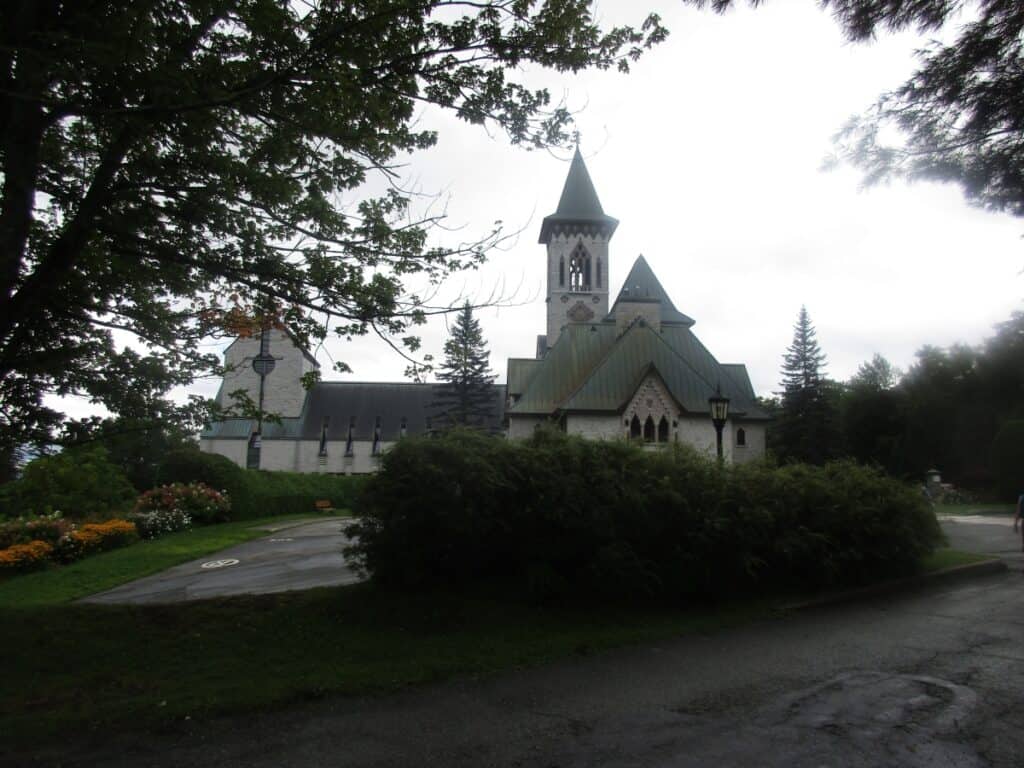
I continued to one of the many wineries, this one with views of the area, and followed up by visiting Saint Benoit-du-Lac Monastery, known for its cheese-making, and yes, I did purchase some. As I was staying in Magog, I took a detour slightly north of the route to nearby Mont Orford National Park, which offers beaches, cycling, boating, and awesome hiking.
In the evening, I continued on the route to the very crowded Laiterie de Coaticook (an Ice Cream Shop) before going to the evening Sound and Light show, with the highlight being the walk across the suspension bridge. The next day in Sherbrooke, I took a walk in the city center, where over 20 massive murals are painted on the sides of buildings. (The tourist office has a free guide with details on each mural, plus the 2 routes.)
9. Le Chemin du Roy

- Historical buildings
- Views of the St. Lawrence River
Le Chemin du Roy was the first carriage road linking Montreal and Quebec City. Today, this 280 km route generally follows the St. Lawrence River at a much slower pace than the nearby parallel 4-lane Highway 40. Along the way are numerous historic homes, museums, parks, and lookouts. This route is also popular with cyclists.
10. Rideau Canal
- City of Kingston
- Westport
- Rideau Lakes
- Merrickville
- City of Ottawa
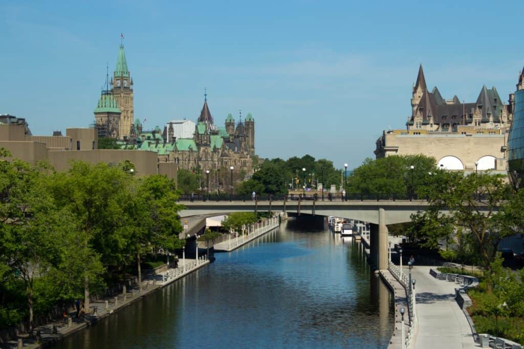
The Rideau Canal route itself is not as interesting as some of the others, but it is the towns along the way which are worth the visit. You can take a boat on the canals, and cycle the route, but there are a series of parallel roads which I took instead.
I started from the historic Kingston on Lake Ontario with Fort Henry guarding the city. My first stop was the first lock of Kingston Mills, which is not too far along the canal. A little further along, I reached Jones Falls, Chaffey’s Locks, and the Rideau Lakes. The town of Westport is particularly well known and popular; however, I stayed on the other side in the even smaller town of Portland.
After passing through Smith Falls, I reached Merrickville, which seems to draw in huge crowds in the summer. There are the locks, of course, and a historic blockhouse, a few ice cream shops, and a lot of people walking around. Then from Kemptville to Manotick, I took a nicer drive on Country Road 13 (or County Road 19 works too) with canal views rather than driving the busy Highway 416. In Ottawa, the canal (flanked by bike trails) goes right through the heart of the city and past the Parliament Buildings through a series of locks before it joins the wide Ottawa River.
11. 1000 Islands Parkway
- Thousand Island Cruises
- Ivy Lea Bridge
- Gananoque
The Thousand Islands Parkway is a 40 km scenic road. I joined the parkway from Highway 401 just west of Brockville at Butternut Bay, where there is a parking lot on the north side used mainly by cyclists. As I drove the parkway from time to time, I could see the St. Lawrence River. Many sections are part of the Thousand Islands National Park, with a Visitor Centre near Malloytown Landing (with washrooms) offering guided hikes. I had passed other trailheads along the route.
When I drove the route in mid-August, there were numerous cyclists on the parallel bicycle trail.
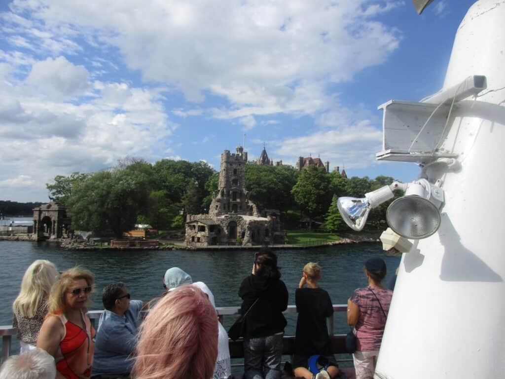
I then took the one-hour 1000 Island Cruise from Ivy Lea, which showed off many of the interesting homes on some of the islands on both the Canadian and American side, including a loop around Bolt’s Castle (the 3-hour cruise makes a stop there). There are also cruises available from Rockport and the resort town of Gananoque where the parkway rejoins Highway 401.
12. Loyalist Parkway
- Glenora Ferry
- Lake on the Mountain
- Sand Banks Provincial Park
- Bird House City
- Wineries and apple cider, too
The Loyalist Parkway starts in Ontario at the edge of Kingston and is also known as Highway 33. It first travels along the shores of Lake Ontario. You will need to take the free ferry ride between Adolphustown and Glenora with its splendid views to arrive in Prince Edward County.
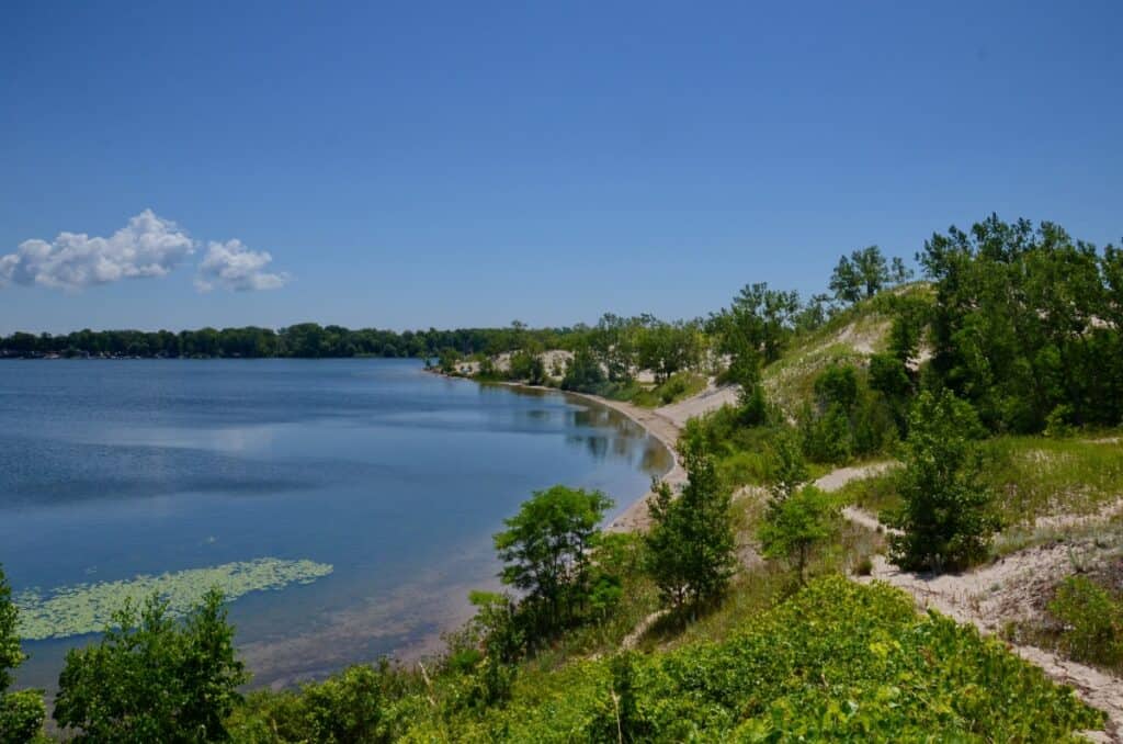
The county is known for Sandbanks Provincial Park (great beaches), wineries, its apple cider, strawberry fields, Lake on the Mountain (great views), and the town of Picton. I made another stop at MacAulay Mountain Conservation Area to see Bird House City with over 100 interesting examples. The Loyalist Parkway ends at Carrying Place near Trenton and Highway 401.
13. Niagara Parkway

- Old Fort Erie
- Niagara Falls and area attractions, including the popular zipline
- Queenston Heights
- Numerous wineries
- Historic Niagara-on-the Lake
As I only live 1 1/2 hours away, I come to this area often. The Niagara Parkway starts in the town of Fort Erie, where Old Fort Erie is a National Historic Site. The grounds have an Interpretative Centre mainly talking about the War of 1812 and guided tours of the grounds, including musket drills, and it wasn’t particularly busy during my midweek August visit.
From the fort, I drove through the town of Fort Erie with the Niagara River on my right, and I could also see Buffalo. The route followed the Niagara River for the first part with frequent lookout points (but not washrooms). There is also the Niagara Recreation Trail for cyclists and walkers running parallel.
Just past the Tim Hortons in Chippewa, there were plenty of parking lots, the WEGO shuttle bus station, and some of the Niagara Falls attractions (Power Plant tower, Maid of the Mist boat ride, and others) as your route takes you right through the heart of town, passing the famous falls. On the far side of Niagara were additional attractions including the Aero Car, Glen Walk, Botanical Gardens, Butterfly Conservatory, and Floral Clock.
At Queenston Heights Park, you can stop to see the impressive statue of Sir Isaac Brock, a hero of the battle fought here in 1812. There are huge picnic grounds, washrooms, and a restaurant with views of the Niagara River. Continue down the hill into the town of Queenston, with many historic homes open to visitors. Further along, pass by several wineries before arriving in Niagara-on-the-Lake, home of Fort George and the Shaw Festival.
What I like about the Niagara Parkway is that, as the name implies, it is like driving through a park with slow traffic, wide grassy areas next to the road, and something to see at every corner, making it one of the best road trips in Ontario. The blossoms are particularly great in the spring.
14. Ontario Highway 60

- Algonquin Park includes the Visitor Centre and Art Museum
- Numerous hiking trails and canoe trip (rentals) routes
- Autumn colours
- Huntsville
Most people only drive Highway 60 for the 126 km from Huntsville to maybe as far as Whitney, but it does actually go a bit further. For me, when visiting, Highway 60 is the gateway to Algonquin Provincial Park, one of the most popular parks in Ontario. The road winds a lot, passing numerous lakes while going up and down many hills. At times, especially in the spring, you can see moose along the side of the road.
There are many picnic areas, hiking trails, and canoe routes along the way. If you stop in the park, you will need a permit. In late September and early October, the fall colours are breathtaking, and you will need to get your permit online in advance as the park sells out on weekends.
Do stop at the Visitor Centre to see the exhibits, the art gallery, the Logging Museum, and perhaps a snack or ice cream at the Lake of Two Rivers Store. I usually go for about 3-4 nights for hiking.
15. Ontario Highway 17 – Sault Ste. Marie to Wawa
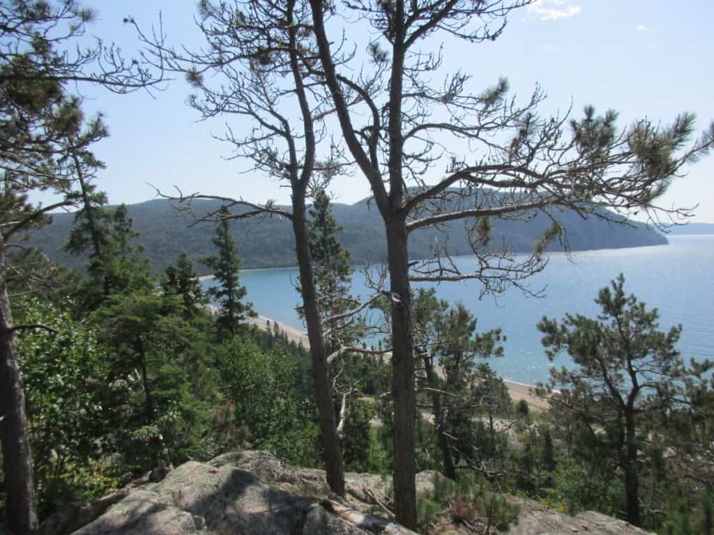
- Batchawana Bay
- Lake Superior Provincial Park has 11 hiking trails with varied terrain
- Agawa Rock Pictographs
- Wawa Giant Canada Goose
The drive on Highway 17 in Ontario, north of Sault Ste. Marie is exceptional. I find the road is rolling, so expect a lot of hills, forests, and lakes, particularly when you reach Lake Superior Provincial Park. One of the campgrounds, as well as the Visitor Centre, is at Agawa Bay, which is where I usually stay. There are 11 hiking trails scattered throughout the park of varied lengths and difficulty. You will also be passing several picnic areas and beaches.
A surprise for me was that in the evening, I saw many of the other campers walking with camp chairs. As I discovered, they were headed to the beach to watch the sunset, and even more surprising is that they seemed to show up every evening.
Most people make a stop to see the over 30 Agawa Rock Pictographs, but how well you can see them depends on the Lake Superior waves, as it can be tough to get too close at times. Just past the northern park boundary, you arrive in Wawa, where you are greeted by a huge Canada Goose statue. Highway 17 continues to Thunder Bay.
Insider Tip: To get to Sault Ste. Marie, I often take a Georgian Bay Road Trip, including Tobermory and Manitoulin Island.
16. Yellowhead Scenic Highway
- Winnipeg
- Saskatoon
- Edmonton
- Jasper National Park, a UNESCO World Heritage site
- Canadian Rocky Mountains
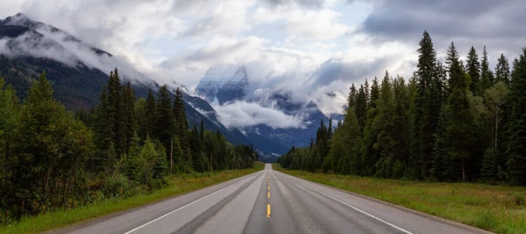
The Yellowhead Scenic Highway is the northern Trans Canada Highway and is also known as Highway 16 (except for a 100 km section in Manitoba). Starting in Winnipeg, the drive is 2,660 km as it continues into Saskatoon and follows the North Saskatchewan River across the prairies. It continues through Elk Island National Park and into Edmonton.
In Jasper National Park, it goes through the Yellowhead Pass through the Canadian Rocky Mountains, where its name originates, and you get amazing scenery. It continues through British Columbia to Prince Rupert and Haida Gwaii. Although a long drive, there is much variety, including cities, National Parks, prairies, and mountain scenery.
17. Kananaskis Trail – Highway 40

- Kananaskis Country Park with hiking, cycling, ski and snowshoe trails
- Mountain views
- Wildlife
I visit this park often, as I have relatives living in Calgary, so it is an easy drive west on the Trans Canada Highway and then south on Highway 40, also known as the Kananaskis Trail. On my last visit to three different spots, Big Horn Sheep were right in the middle of the road, so we had to drive with caution past them. However, you may be staying at one of the hotels in Kananaskis Village.
Most people are driving here to enjoy the mountain scenery while hiking or cycling in the summer months. In the winter, the former Olympic downhill course is here, and there are also cross-country ski trails and separate snowshoe routes. In winter, sections to the south are closed.
Heading north, Highway 40 goes by the name Bighorn Highway, not a surprise, as you are sure to see them along the route, as I did.
18. Icefields Parkway
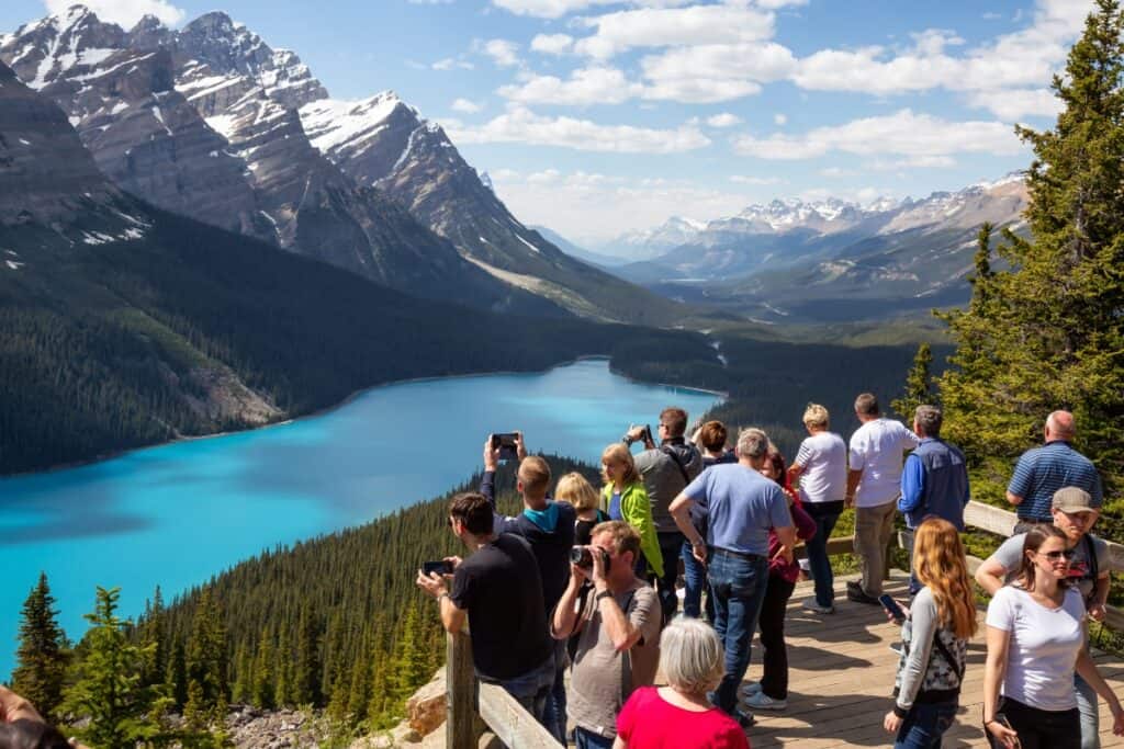
- A UNESCO World Heritage Site
- Banff National Park and Lake Louise
- Columbia Icefields
- Wildlife
- Athabasca Falls
- Jasper National Park
For its 232 km, the Icefields Parkway is rated as one of the top scenic drives in the world. Although Banff is not part of the parkway, most people start from there or nearby Canmore and first take the equally short but scenic Bow Valley Parkway, stopping at Johnston Canyon to see the waterfalls. Note that a 17 km section of the Bow Valley Parkway is closed in May/June and September to vehicles and is only open to cyclists.
Still in Banff National Park is the resort of Lake Louise with famous hotels, restaurants, a walk along the shores of the lake, and a hike up to the Tea Room in the mountains. Continue north along Highway 93 as the Icefields Highway is also named and through the mountains, passing numerous lakes and river crossings. Partway along, you will reach the Columbia Icefields,s where you can get a ride to take a closer view.
In Jasper National Park, there are numerous hiking trails, including Athabasca Falls right beside the parkway, before you roll into the town of Jasper with numerous hotels, lodges, and restaurants.
Full-day tour of the Icefields Parkway and Lake Louise from Banff or a self-guided audio tour.
19. Crowsnest Highway
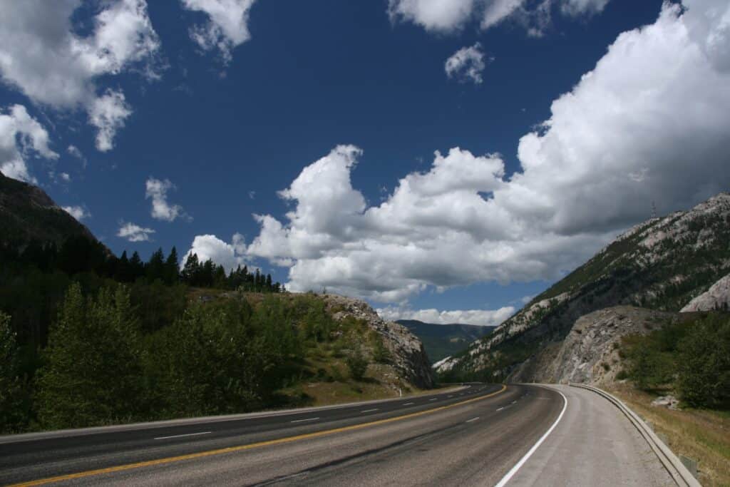
- Drive through the mountains
- Section of the Okanagan Valley
- Crosses southern BC and Alberta
Taking the 1,161 km Crowsnest Highway, I was to be driving through mountains for almost the entire distance. I started in Hope, BC, where it connected with the Trans Canada Highway and headed east on the Crowsnest, also known as Highway 3, through Manning Provincial Park and then the southern Okanagan Valley near Osoyoos.
It skirts the U.S. border on its way to Cranbrook and Fernie, and through the Crowsnest Pass, where it got its name, and into Alberta and on to Lethbridge. While in southern Alberta, this route connects with the 584 km Cowboy Trail (Highway 22) heading north.
20. Golden Triangle Road Trip
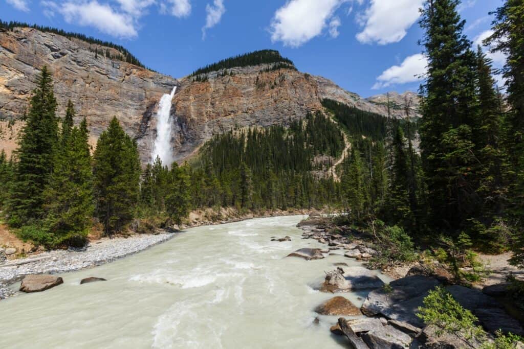
- 3 National Parks – Banff, Yoho and Kootenay
- Mountain vistas
- Towns of Radium and Golden
- Lots of hiking opportunities
There are several Golden Triangles around the world, but I first learned about this route from a relative who lives in Calgary and travels it often. From Banff, head north and then west on Highway 93, crossing the continental divide into Kootenay National Park in British Columbia before heading downhill into the town of Radium to spend the first night.
Heading out of Radium, I would be going north on Highway 95 to Golden, with hiking including several suspension bridges or going river rafting, and you spend your second night. Then continue east through Yoho National Park, visiting Takakkaw Falls and also that view of Emerald Lake that you always see in the tourist photos.
The final stretch is back into Banff National Park and Lake Louise, with its lakeside stroll or slightly more challenging hike to the Tea Room before finishing back in Banff.
21. Sea to Sky Highway
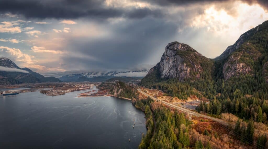
- Vancouver
- Squamish gondola ride
- Whistler Village
I have only driven this route once, actually twice, as I returned the same way and was in awe the entire journey. Actually, not that long at 163 km from Vancouver to near the ski resort of Whistler, where I was headed. I started in Vancouver and headed along Highway 99 to Squamish, where the Coast Mountains meet the ocean. In Squamish, you will want to take the gondola ride and hike some of the trails. A close friend who has family there tells me they are always meeting bears on the edge of town and along the many hiking trails, so take care.
Continue to Whistler Village, one of the top ski resorts in North America. In the summer, go take a gondola, go hiking in the mountains, or go on the popular zipline adventure.
22. Pacific Rim Highway

- Pacific Rim National Park
- Resort towns of Tofino and Uclulet
- Port Alberni hiking, including the Hole in the Wall Trail
Highway 4 starts at Port Alberni on the east coast of Vancouver Island, and you head west across the island to the very popular towns of Tofino and Uclulet. When you arrive, you will want to explore the beaches and surf or visit Pacific Rim National Park. This is a popular route and extremely busy in the summer.
23. Stewart-Cassiar Highway

- One of 2 routes in BC to the Yukon and Alaska
- Wilderness route
- Wildlife
The Stewart-Cassiar or Highway 37 is one of two routes in north British Columbia going to the Yukon. Remote, but beautiful, the route starts just north of the Yellowhead Highway near Terrace at Kitwanga, going north for about 875 km until reaching the Yukon border near Watson Lake. Most people driving this route are on their way to or from Alaska or the Yukon.
24. Chilcotin Highway
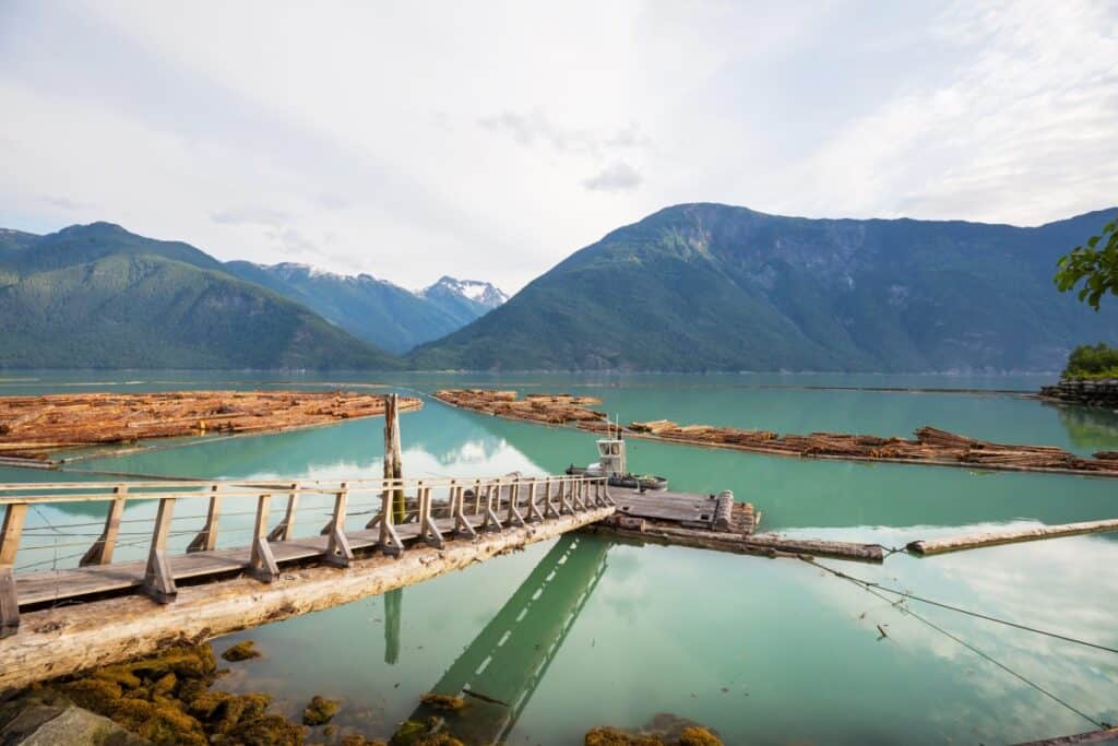
- Tweedsmuir Provincial Park
- Grizzly bears
Another isolated highway in British Columbia, this one #20 goes from Williams Lake to Bella Coola for about 457 km. Bull Canyon Provincial Park lies along the Chilcotin River with rugged cliffs. Tweedsmuir Provincial Park is BC’s largest and offers over a dozen hiking trails, canoeing, and fishing. Again, this is a remote route with few towns.
25. Klondike Highway

- Skagway
- Whitehorse
- Dawson City
This highway basically follows the route of 98, the Klondike Gold Rush, when people went from Skagway in Alaska to Whitehorse and Dawson City in the Yukon Territory. Today, it is a 715 km highway, although many visitors take the White Pass & Yukon Railway for part of the route.
In Dawson City, you can relive the Gold Rush Days or go on a scenic flight over the area. Whitehorse is the capital of the Yukon, with many hiking and boating opportunities. History buffs will appreciate this route.
FAQs: Scenic Drives in Canada
What is Canada’s most beautiful road?
The Icefields Highway (#93), going through the Canadian Rocky Mountains from Banff National Park to Jasper National Park for 232 km, is considered to be Canada’s most scenic drive.
What is the longest road drive in Canada?
The Trans-Canada Highway goes through all 10 provinces, starting in Newfoundland and all the way to Vancouver for 7,821 km.
Additional information for planning your road trip
- A list of the Canadian UNESCO World Heritage Sites to include on your road trip
- Some road trip essentials you may need on your trip.
Final Thoughts: Most Scenic Drives in Canada
This list includes many amazing routes, but my favourites are the Icefields Parkway (Alberta), Ontario Highway 17, and the Sky to Sea Highway in B.C.
Using any one of these 25 Canadian scenic drives is the best way of making a great road trip with plenty of cities, history, scenery, and natural wonders to see.


